Myth: Water Can't Run Out
The water cycle is taught to every child, and the lesson most of them take from it is that water goes round and round and can never be used up. The first part is true. The second part is the most comforting mistake in the subject, and this site exists partly to correct it. What runs out, where, and how fast.
Every child learns the water cycle. Water evaporates from the sea, rises, cools, falls as rain, runs to the river, and returns to the sea, and the diagram on the classroom wall has arrows that go round in a circle with no beginning and no end. The lesson is correct. The amount of water on the planet has been more or less the same for billions of years, and nothing that a farm, a city or a factory does can destroy a molecule of it. From this, most people draw a second conclusion, usually without noticing that they have drawn it: that water cannot run out.
It is the most comforting mistake in the subject, and one that this site spends most of its time, one article at a time, undoing. This piece is about it directly. Water as such never runs out. What runs out is water of the right kind, in the right place, at the right time, and the difference between the two is the whole of the water business.
The cycle, and the bank
The water cycle describes a flow. About 500,000 cubic kilometres of water evaporate and fall back every year, most of it over the ocean, and the flow is what keeps rivers running and aquifers filling. The flow is enormous and, over the planet as a whole, indifferent to human use. Nothing anyone does changes how much rain falls in a year by more than a rounding error.
People, though, draw on stores rather than on the flow, and the flow feeds them: rivers, lakes, soil moisture, snowpack, and, above all, groundwater. Each store has a rate at which the cycle refills it and a rate at which it is drawn down, and where the second exceeds the first, the store falls. It does not matter that the water still exists somewhere. A farmer in Kansas whose well runs dry is not consoled by the rain over the Pacific. The cycle is real, and the bank account is local.
| Where the Earth's water is | Share |
|---|---|
| Oceans, salt | About 97 percent |
| Ice caps and glaciers | About 2 percent |
| Groundwater | Most of the rest, under 1 percent |
| Lakes, rivers, soil, air, living things | A few hundredths of a percent |
The article on the 0.3 percent on this site walks through that table. The point of it here is the last two rows. The water people actually reach is a sliver of the total, and the largest part of that sliver is underground, where the refill rate is slow and the drawdown, since the arrival of the diesel pump, has been fast.
Old water
Most groundwater is old. A study published in 2016 that dated the world's groundwater found that only a small fraction of it, in the top layers, had fallen as rain within the last fifty years. The rest had been in the ground for centuries or millennia, and a large share of the water now being pumped for irrigation is of that kind. It was laid down in wetter ages, when the climate of the place was different, and the rain that falls there today refills it slowly or not at all. Hydrologists call it fossil water, and the name is apt: it is being extracted like coal, from a deposit that formed under conditions that no longer exist.
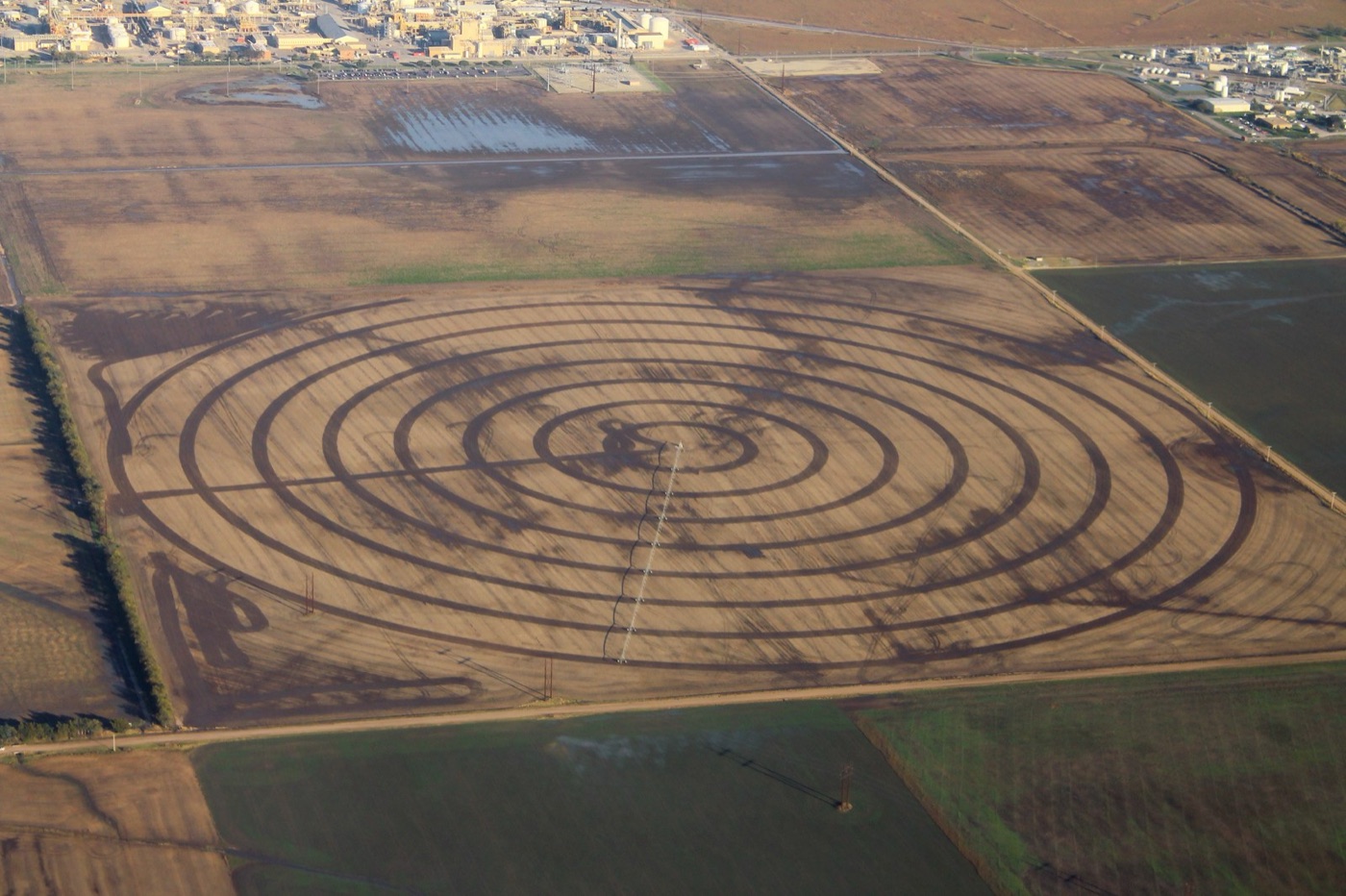
The Ogallala aquifer, under the Great Plains of the United States, is the best studied case. It stretches under eight states, it filled during and after the last ice age, and since the 1950s it has irrigated the maize, wheat and cattle feed of Kansas, Nebraska, Texas and Oklahoma. In the southern part, water levels have fallen by more than thirty metres, wells that once flowed have been abandoned, and the aquifer, at present pumping rates, will be effectively exhausted across large areas within decades. The rain over Kansas refills it at a few millimetres a year. The pumping takes out closer to a metre.
The same story, with different names, runs through north west India and Pakistan, where the aquifers of the Punjab have fallen fastest of any on Earth over the last twenty years, through the North China Plain, through Iran and Saudi Arabia, which pumped fossil water to grow wheat in the desert until it announced in 2008 that it would stop, and through the Nubian sandstone under the Sahara, whose water fell as rain ten thousand years ago when the desert was a savannah, and which Libya pipes north to its coastal cities through what it called the Great Man Made River.
| Aquifers being mined | Where the water came from | What is happening |
|---|---|---|
| Ogallala, US High Plains | The last ice age | Down over 30 metres in the south; decades left in places |
| North west India and Pakistan | Monsoons of past centuries | The fastest decline measured by satellite |
| North China Plain | Past millennia | Beijing sinking; water now piped from the Yangtze |
| Arabian aquifers | The wet Sahara and Arabia of 10,000 years ago | Saudi wheat ended; supply now desalinated |
| Nubian sandstone, Sahara | Rain of 10,000 years ago | Piped to Libya's coast; not refilling |
Watching it from orbit
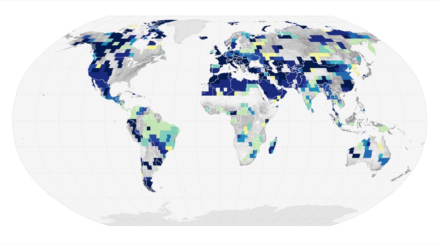
For most of history the state of an aquifer was known, if at all, from the wells drilled into it, which is like judging a bank account by the queue at one branch. Since 2002 a pair of satellites, called GRACE, has measured the Earth's gravity finely enough to detect the mass of water moving in and out of the ground beneath them, and their maps of the last two decades are the clearest picture of the myth failing. The regions in red, where the mass of stored water is falling year on year, are the irrigated plains of the world: north west India, the North China Plain, the Central Valley of California, the Middle East, the Ogallala. The regions in blue, gaining water, are mostly the wet tropics and the high latitudes, where nobody is short. The satellites confirm what the wells suggested, which is that water is moving, over decades, from the places that farm to the places that do not.
The other things that run out
Groundwater is the clearest case, and it is not the only one. Three other stores are being spent, and each is described elsewhere on this site.
Rivers run out at the mouth. The Colorado, the Yellow River, the Indus, the Murray and the Amu Darya of the Aral Sea article have all, in dry years or in every year, stopped reaching the sea, because the water was taken out along the way. The water cycle delivered it. The people along it spent all of it.
Snow runs out in summer. A large share of the world's farms and cities, from California to the Indus to the Andes, depend on snowpack and glaciers that store winter precipitation and release it through the dry season, and in a warming climate more of the winter falls as rain and runs off at once, and the glaciers that fed the rivers of Asia in the dry months are shrinking. The water still falls. It falls at the wrong time and does not wait.
And clean water runs out. Water that is too salty, as the brine and TDS articles explain, or too contaminated, as the arsenic and PFAS articles do, is water that exists and cannot be used, and its share is growing. A river of sewage is a river, hydrologically. It is not a supply.
What refilling looks like
A store that can be spent can be refilled, and the places that have understood the myth's failure have started to do it. Arizona has, since the 1990s, banked surplus Colorado River water in its aquifers by spreading it in basins and letting it soak in, several million acre feet of it, against the shortages now arriving. Orange County, described in its own article, refills its aquifer with treated sewage. Chennai's roofs, described in theirs, send the monsoon into the ground beneath the city. India's villages have built hundreds of thousands of check dams and recharge pits for the same purpose, and the aquifers under the districts that built most of them have, in the satellite record, begun to rise. The technique is old and simple. It is a matter of slowing water down on its way to the sea so that it soaks in, and of treating the ground as the reservoir it is. What it needs, in every case, is a decision that the store matters, made before it is empty rather than after, and that decision is easier to make in a place that has stopped believing the diagram on the wall.
What the cycle does not say
None of this contradicts the diagram on the classroom wall. The water that Kansas pumps evaporates from the maize and falls, eventually, somewhere, and the world's total is unchanged. What the diagram does not say is that the somewhere is not Kansas, that the eventually is not this year, and that the store the farmer drew from took ten thousand years to fill. The cycle is a description of the planet. Water supply is a description of a place, and a place can run out.
The useful version of the lesson, the one this site tries to teach in every article, is that water is a local budget of stores and flows, that each store has a refill rate, and that the number to know is not how much water there is but how fast the store you depend on is being refilled, and how fast it is being drawn down. In a wet country with a full river the answer is that there is plenty. On the plains of Kansas, the Punjab or the North China Plain, the answer is a date.
What it teaches
Water cannot be destroyed, and it can absolutely be used up, in the only sense that matters to anyone standing at a well. The comfort of the cycle is real and it is planetary. The problem is regional, and it is the regions that grow the food.
Ten thousand years to fill, and a few decades to spend. That is the arithmetic the diagram leaves out.
Sources
- Rodell, M. et al. (2018). Emerging trends in global freshwater availability. Nature 557. GRACE satellite observations of groundwater depletion in north west India, the North China Plain, the Middle East and the US High Plains.
- Wada, Y. et al. (2010). Global depletion of groundwater resources. Geophysical Research Letters 37.
- USGS, High Plains Aquifer water level monitoring: declines of over 30 metres in parts of Kansas and Texas since predevelopment.
- Gleeson, T. et al. (2016). The global volume and distribution of modern groundwater. Nature Geoscience 9. Most groundwater is older than 50 years; much is thousands of years old.
- Shiklomanov, I.A. (1993). World fresh water resources. In Gleick, P.H. (ed.), Water in Crisis. The distribution of the Earth's water.
- Photographs: opener: Clay cracked by L. Shyamal (CC BY-SA) via Wikimedia Commons; inline: Concentric Circle Farmland (50902375916) by formulanone (CC BY-SA) via Wikimedia Commons; inline: Global Freshwater Abruptly Declines (153608 - lrg) by NASA Earth Observatory image by Wanmei L (public domain) via Wikimedia Commons.