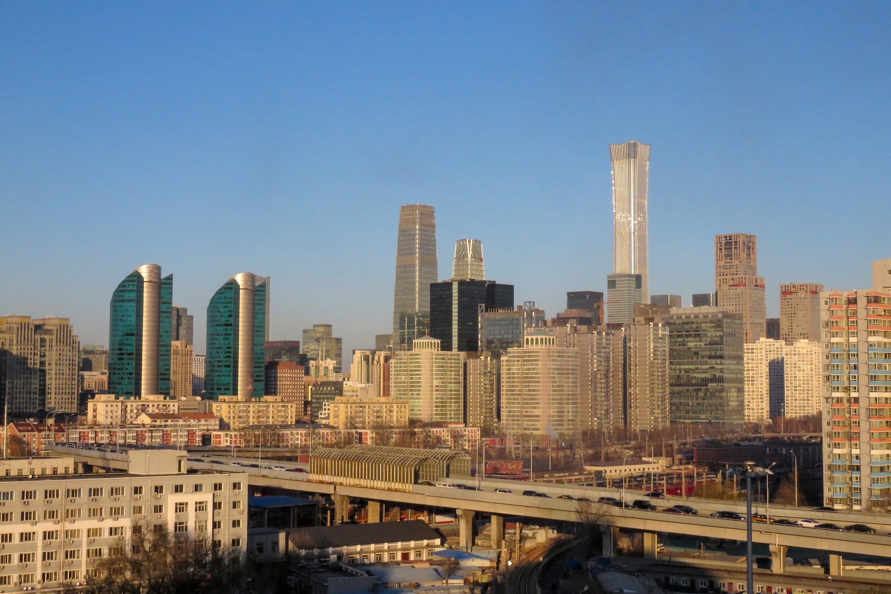
Thirsty Places: Beijing
The capital of China has less water per person than Saudi Arabia, and for forty years it drank the aquifer beneath it until the ground sank and the wells ran dry. The answer was the largest water transfer ever built, a canal fourteen hundred kilometres long that carries a river from the south to the north. What Beijing's water is, what the transfer cost and delivered, and why a city can be saved by a canal and still be running out.
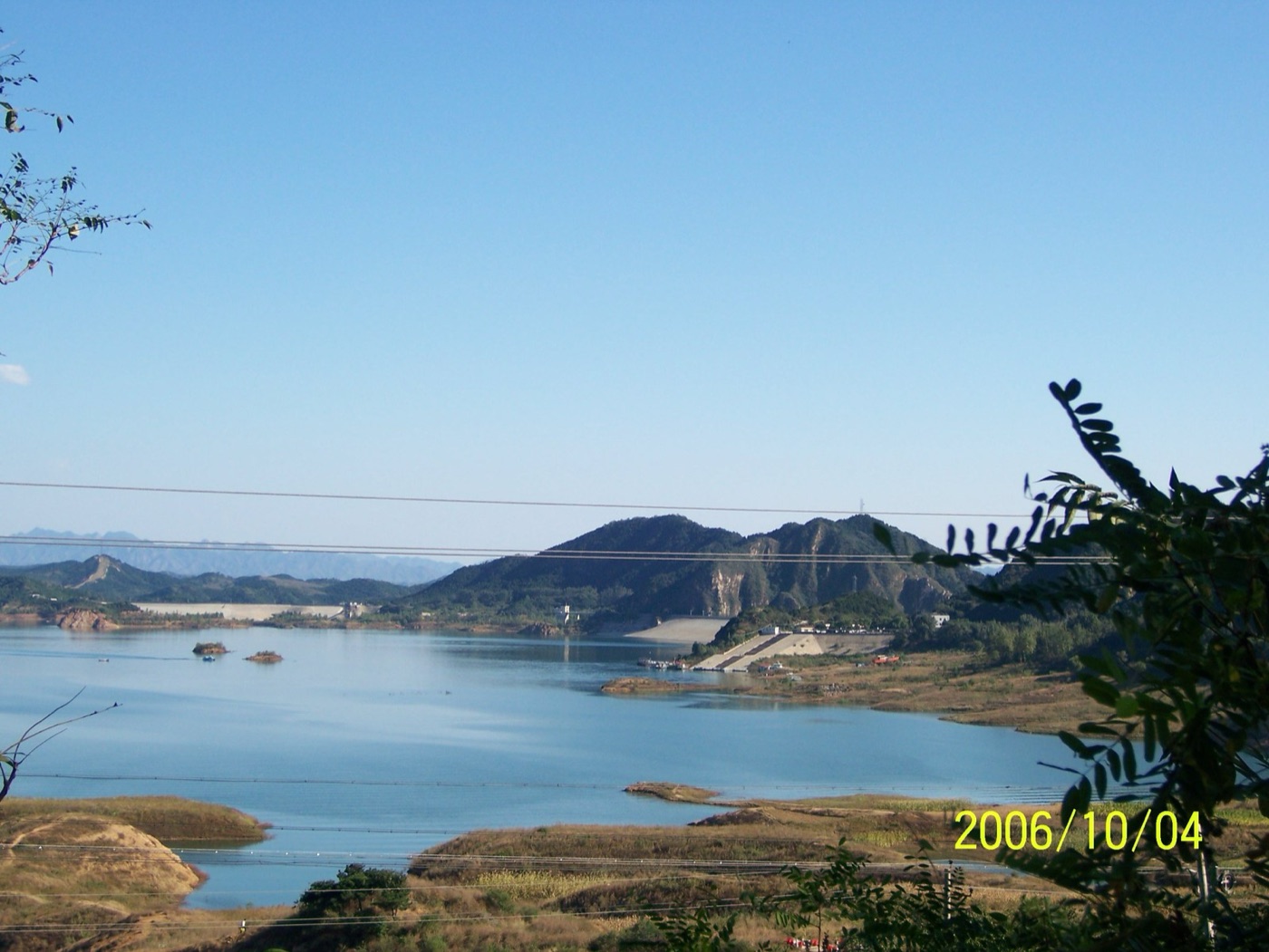
North of Beijing, in the hills where the Great Wall runs, there is a reservoir called Miyun that was, for fifty years, the capital's main source of water. Through the 2000s it fell, year by year, as the rivers that fed it were dammed and diverted upstream and the rain failed, until by 2014 it held about a tenth of its capacity and the city had stopped counting on it. Beijing was drinking the ground. Its wells had been sunk deeper every year since the 1970s, the water table under the city had fallen by tens of metres, and the North China Plain, which grows a large share of the country's wheat, had become, in the satellite record described in the myth article, one of the fastest emptying aquifers on Earth.
The answer was a canal. This article is about the largest water transfer ever built, the city it was built for, and the question every such project raises, which is whether a city that has been given a river has been given a supply or a reprieve.
The driest capital
Beijing sits on the northern edge of the North China Plain, in a climate of dry winters and a short wet summer, with an average of about 600 millimetres of rain that in dry years falls to 400. It has no large river. Its water per person, by the city's own accounting, is around a hundred cubic metres a year, against a national average of two thousand and a United Nations threshold for absolute scarcity of five hundred. That is less than Israel, less than Saudi Arabia, and it is shared among twenty two million people, in a city that has grown by ten million since the 1990s.
For most of that growth the city lived on two things. The first was its reservoirs, Miyun and Guanting, which caught the rivers from the north and west and which shrank as those rivers were used upstream. The second was the aquifer, tapped by tens of thousands of wells, municipal and private, which supplied two thirds of the city at the peak and which fell, in the years around 2000, by about a metre a year. The land above it sank, as it does in the Mexico City and Jakarta articles, by tens of centimetres a year in the eastern suburbs, and the wells of the farming villages around the city ran dry.
| Beijing's water | |
|---|---|
| Population | About 22 million |
| Water per person per year | About 100 cubic metres; the UN scarcity line is 500 |
| Rainfall | About 600 millimetres, mostly in July and August |
| Share of supply from groundwater, before 2014 | Around two thirds |
| Water table decline, 1990s and 2000s | About a metre a year |
| Share of tap water from the transfer, now | Around two thirds |
The transfer
The idea is attributed to Mao, who remarked in 1952 that the south had plenty of water and the north little, and that borrowing some would be fine if it could be done. It took fifty years to begin and twelve to build. The South to North Water Transfer has three planned routes. The eastern route pumps Yangtze water north along the old Grand Canal to Shandong and Tianjin, and opened in 2013. The western route, through the mountains of the Tibetan plateau, remains on paper. The central route is the one that saved Beijing.
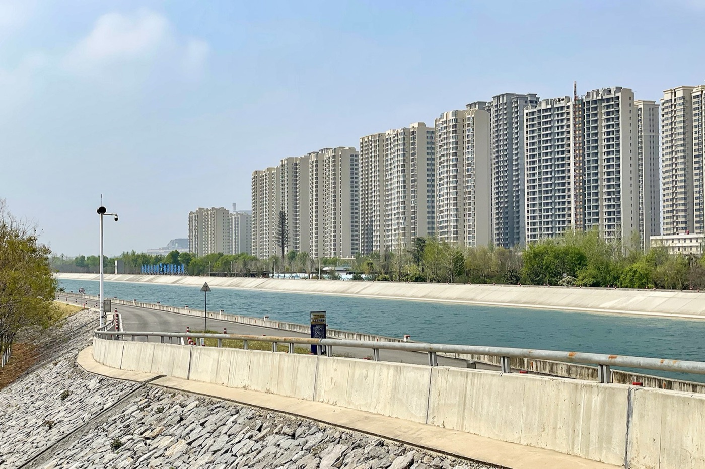
It begins at the Danjiangkou reservoir on the Han River, a tributary of the Yangtze in Hubei, whose dam was raised by fifteen metres to store the water, and it runs 1,432 kilometres north, by gravity, in an open concrete canal, under the Yellow River through twin tunnels, across hundreds of rivers, roads and railways on aqueducts and siphons, to Beijing and Tianjin. It opened in December 2014 and it is designed to carry 9.5 billion cubic metres a year, of which Beijing's share is about 1.2 billion, roughly a third of everything the city uses and about two thirds of what comes out of its taps.
| The central route | |
|---|---|
| Source | Danjiangkou reservoir, Han River, Hubei |
| Length | 1,432 kilometres, by gravity |
| Design capacity | 9.5 billion cubic metres a year |
| Opened | December 2014 |
| Beijing's share | About 1.2 billion cubic metres a year |
| People resettled from the reservoir | About 345,000 |
| Cost, all routes | Tens of billions of dollars; official figures around 80 billion |
What it has done
The canal has done what it was built to do, which in this series is unusual enough to say plainly. Beijing's tap water now comes mostly from the Han River. The city has cut its groundwater pumping by a large share, closed thousands of wells, and the water table under the city, which had fallen for forty years, began to rise in 2016 and has risen by several metres since. Miyun reservoir, which the city could no longer fill from its own rivers, is being filled from the canal, pumped uphill from the city to the hills, so that the capital has a store again. The eastern suburbs have stopped sinking as fast. And the water in the taps is softer and cleaner than the deep groundwater it replaced, which the residents noticed before the officials announced it.
The canal has also done what its critics said it would. The Han River below the dam carries a third less water, and the cities along it, Xiangyang and Wuhan among them, have had to build their own works to make up for it, including a second transfer from the Yangtze into the Han, a canal to feed the canal. Three hundred and forty five thousand people were moved from the shores of the raised reservoir, to new villages that many of them found poorer than the old, and the compensation was the argument it always is. The water travels through a landscape of factories and farms, and keeping it clean over fourteen hundred kilometres has meant closing plants along the route and fencing the canal for its whole length. And the price: the water arrives in Beijing at a cost several times what the groundwater cost to pump, and the city's tariffs have risen to pay for it, which is, from the point of view of this site, the least bad of the consequences.
The water in the canal
What the canal carries deserves its note, because a river moved fourteen hundred kilometres is a river exposed to fourteen hundred kilometres of country. The Han's water at Danjiangkou is clean, and the state spent heavily to keep it so, closing hundreds of factories and farms in the reservoir's catchment, relocating the polluting industries of the upstream towns, and planting the shores. The canal itself is fenced, bridged rather than crossed, and monitored at stations along its length for the algae that a slow open channel in summer will grow and for anything that might be spilled into it. The water arrives in Beijing softer than the deep groundwater the city drank before, and the utility had to adjust its treatment and its pipes for it, because water of a different chemistry loosens the scale inside old mains and, for a few months in 2015, turned some districts' taps yellow. It is the kind of detail the leaks article describes: a city's pipes are tuned to a water, and a new water is a new set of problems along with a new supply.
The time it bought
What the canal has not done is make Beijing's water enough. The city uses about four billion cubic metres a year and has, from its own rain, reservoirs and a sustainable share of its aquifer, perhaps two and a half. The canal supplies a little over one. The gap is closed by reclaimed water, which Beijing now produces at a scale second only to the reuse capitals of this series, treating its sewage to a standard used for its parks, rivers, power stations and industry, and by a demand that has been held roughly flat, through pricing, quotas on industry, and the relocation of the water hungry steel and chemical works that once ringed the city. The population has, since 2017, been capped by policy at around 23 million, in part for water.
The city has, in other words, been given a river and has used it to stop mining its ground, which is the right use, and it has done so while still using more than it has. The canal's own water depends on the Han's rain, which failed in 2014 and again in 2022, when the Danjiangkou reservoir fell low enough to restrict the transfer. A canal moves water. It does not make it, and the Yangtze basin, whose surplus the whole scheme assumes, had its own drought in 2022 that dried the river at Wuhan and cut the hydroelectric power of Sichuan. The south's plenty is a fact of the twentieth century's climate, and the transfer is a bet that it will hold.
What it teaches
Beijing is the clearest case on this site of the engineering answer working. The city was emptying its aquifer, the canal arrived, the pumping stopped, the ground stopped sinking and the water table rose. It is also the clearest case of what the engineering answer costs: a river taken from the people who lived on it, a third of a million moved, a landscape fenced, and a capital whose water now depends on the rain over a province a thousand kilometres away. The canal bought the city a decade to bring its use down to its supply. Whether it is used that way, or used to grow, is the question every city given a new source has faced, from Los Angeles to Chennai, and the honest reading of Beijing's numbers is that it is doing both.
1,432 kilometres of concrete, a river in a canal, and a city that is still, by its own count, short.
Sources
- Ministry of Water Resources of China and the South to North Water Diversion Office: central route length, design flow of 9.5 billion cubic metres a year, and deliveries to Beijing since December 2014.
- Beijing Water Authority, annual water resources bulletins: per capita availability, the share of supply from the transfer, and groundwater level recovery since 2015.
- Rodell, M. et al. (2018). Emerging trends in global freshwater availability. Nature 557. North China Plain groundwater depletion.
- Zhao, X. et al. (2017). Burden shifting of water quantity and quality stress from megacity Shanghai. Water Resources Research 53, and related work on virtual water and the transfer.
- Reporting by Reuters, the New York Times and Caixin on resettlement from the Danjiangkou reservoir and on water quality along the canal.
- Photographs: opener: Beijing CBD Skyline (20190104160952) by N509FZ (CC BY-SA) via Wikimedia Commons; inline: 20230331 Central Line of South–North Water Transfer in Jiaozuo by Windmemories (CC BY-SA) via Wikimedia Commons; inline: Miyun, Beijing, China - panoramio (18) by liyuhanrenll (CC BY) via Wikimedia Commons.