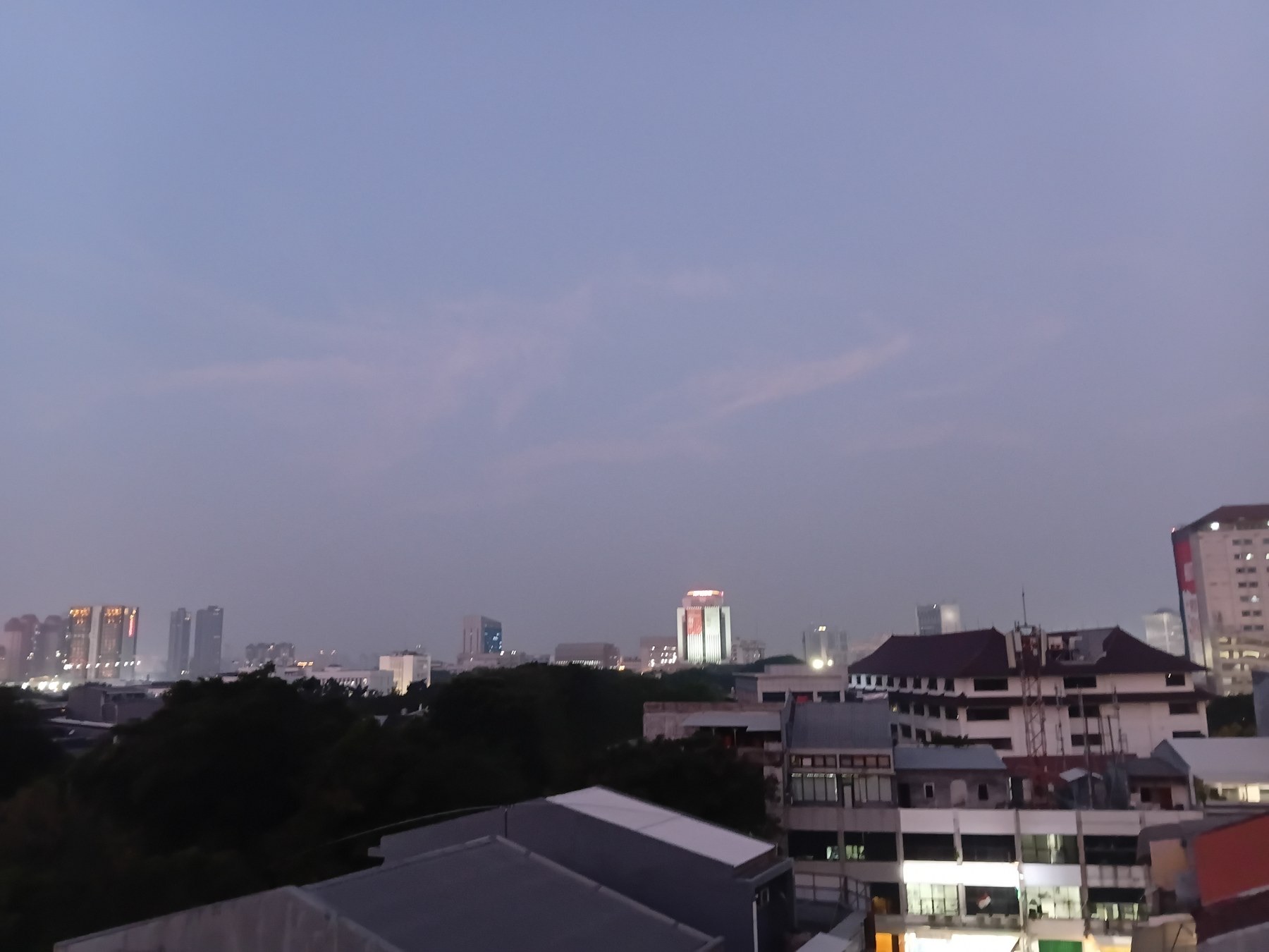
Thirsty Places: Jakarta
The capital of Indonesia is sinking faster than any large city on Earth, up to twenty five centimetres a year in its northern districts, because ten million people pump the ground beneath them for water the pipes do not deliver. Two fifths of the city is already below sea level, a wall is being built along the coast, and the government is moving the capital to another island. What Jakarta's water is, why the pipes failed, and whether a city can stop sinking.
In the district of Muara Baru, on the northern edge of Jakarta, there is a mosque whose floor is below the sea. The building stands a few hundred metres from the coast behind a concrete wall, and the wall is higher than the mosque's roofline, and the ground on the seaward side of the wall is the level the ground on the landward side used to be. The mosque has not moved. The land under it has gone down, by several metres in forty years, and it is still going down, at a rate that in this part of the city reaches twenty five centimetres a year.
Jakarta is the fastest sinking large city on Earth, and the reason is water. This article is about a capital of ten million people that drinks the ground beneath it because its pipes do not deliver, about what the sinking has done, and about what a country does when its capital is going under.
A city on a delta
Jakarta lies on the north coast of Java, on the low flat delta of thirteen rivers that drain the volcanic hills to the south. The land is young sediment, clay and sand, soft and saturated, of the same kind that underlies Mexico City and, in the arsenic article, the villages of Bangladesh. The Dutch built their colonial capital here in the seventeenth century, on canals, in a place that flooded then and floods now.
The city grew from a few hundred thousand people at independence in 1945 to ten million today, with twenty more in the metropolitan area around it, and its water supply did not grow with it. The piped network, built by the Dutch and expanded fitfully since, reaches about two thirds of the city, and where it reaches, it often runs at low pressure, for a few hours a day, with water that many residents do not trust. So the city drilled. Every house that could afford it sank a well, every apartment tower, hotel, mall and factory sank a deeper one, and the aquifer that had lain under the delta for thousands of years began to be pumped out at a rate that no rain could replace.
| Jakarta's water | |
|---|---|
| Population, city | About 10 million; about 30 million in the metropolitan area |
| Piped water coverage | About two thirds of the city |
| Share of the city drawing on wells | Most buildings, including large ones |
| Subsidence, north Jakarta | Up to 25 centimetres a year |
| Cumulative subsidence since the 1970s | Up to 4 metres in places |
| Share of the city below sea level | About 40 percent |
What sinking does
Sediment that is full of water is held up by the water. Pump the water out and the grains settle closer together, and the surface above them drops. It is the same process as under Mexico City, and Jakarta's version is faster, because the sediment is younger and softer and the pumping is less controlled. Surveys have measured the northern districts falling by ten to twenty five centimetres a year for three decades, and by a metre or more in a decade in the worst places, and the total since the 1970s is around four metres along parts of the coast.
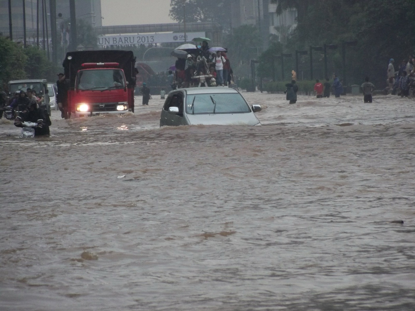
The consequences are the ones a coastal city cannot afford. The land that was at sea level is now below it, and the sea comes in: at high tides, in storms, and, in 2007, in a flood that put half the city under water. The rivers that once ran downhill to the sea now reach a coast that is lower than the city behind it, and their last kilometres have to be pumped. The flood walls, built to a level, sink with the land and have to be raised again, and again. Roads crack, buildings tilt, sewers and water mains break, and the water mains that break lose the water that would have replaced the wells, which is the same loop the Mexico City article describes, turning a little faster.
The pipes
The reason the city pumps is the reason the pipes do not deliver, and the reason the pipes do not deliver is history. Jakarta's water was privatised in 1997, under a pair of concessions to foreign operators that promised to expand the network and did not, through the Asian financial crisis, the fall of the government, and two decades of argument that ended with the courts returning the system to the city in 2019. In those years the network reached perhaps a third more of the city, lost around 40 percent of its water to leaks and theft, and lost the trust of its customers, who kept their wells.
The city's utility now plans to connect everyone by 2030, with new treatment plants on the rivers to the south and on a reservoir to the east, and with a regulation, already on the books and lightly enforced, that bans groundwater pumping in districts where piped water is available. Tokyo, described in the leaks article, stopped its own subsidence in the 1970s by exactly this: it piped water to everyone, banned the wells, and the ground stopped falling within a few years. Jakarta knows the recipe. What it has lacked is the pipes, and the will to shut the wells of the buildings that own the deepest ones.
| Why Jakarta pumps | |
|---|---|
| Piped coverage | About two thirds, often intermittent and distrusted |
| Network losses | Around 40 percent |
| The 1997 concessions | Expansion promised, not delivered; ended in 2019 |
| The rule | Pumping banned where pipes exist; weakly enforced |
| The precedent | Tokyo stopped sinking within years of shutting its wells |
The rivers that run uphill
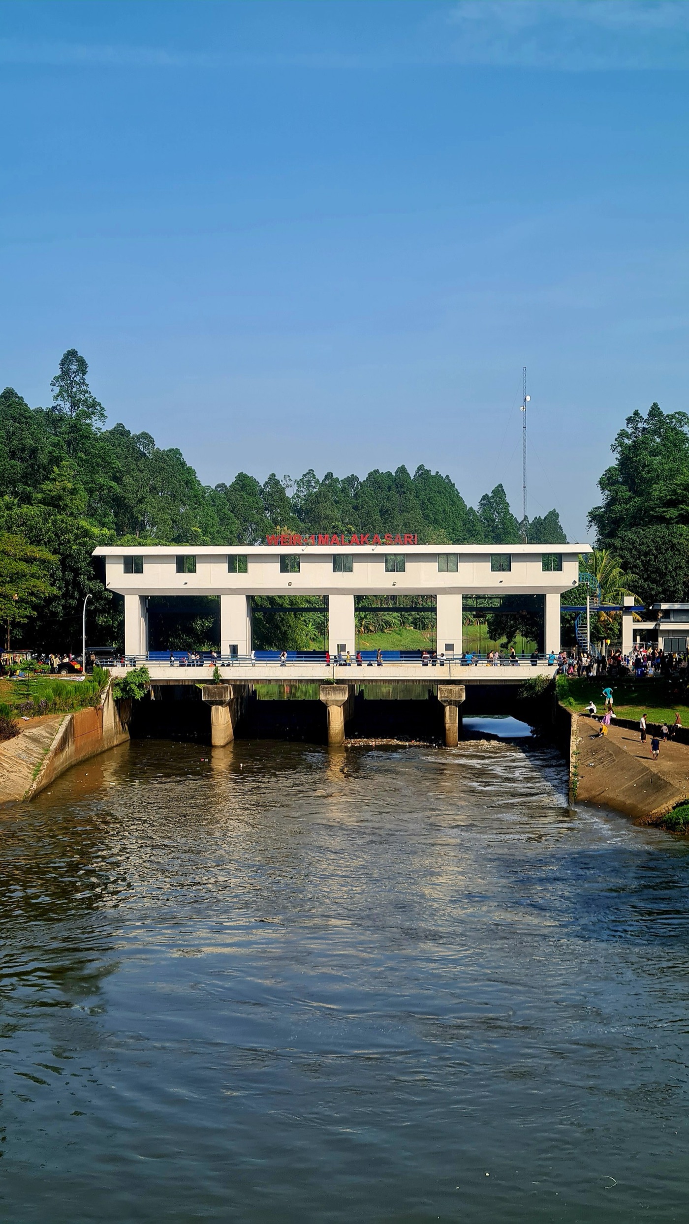
The thirteen rivers that cross Jakarta were, when the city was built, its drains. They carried the monsoon off the hills to the south, through the city, and out to the bay. As the northern districts sank below the level of the sea, the last kilometres of those rivers sank with them, and the water that once flowed out now has to be lifted. The city runs a chain of pumping stations along its coast and its canals, and in the rainy season, when a storm on the hills sends a flood down rivers whose mouths are below the tide, the pumps decide whether the north of the city floods. In 2007 and again in 2013 and 2020 they did not keep up, and the floods reached the presidential palace. A city that has to pump its rivers to the sea is a city whose drainage is running on electricity, and the electricity, in a storm, is the first thing to fail.
The wall
While the pipes are laid, the sea has to be held, and the plan for that is one of the largest works ever proposed for a city. The Giant Sea Wall, in its fullest version, is a dyke tens of kilometres long across the bay, in the shape of a bird, enclosing a lagoon that would be pumped down below sea level and lined with new land. It was designed with Dutch engineers, the same tradition that built the country's polders, and it has been announced, revised, scaled back and re announced several times since 2014. The first stage, a raised coastal wall along the existing shore, has been partly built and has already, in places, sunk with the ground it stands on.
The wall is the answer to the symptom. A city that stops pumping stops sinking, and a wall that is not sinking with the city can be built once. A city that keeps pumping will need a higher wall every decade, and there is a limit to how high a wall can be built on ground that is going down beneath it.
The capital that moved
In 2019 the government announced that it would move the capital of Indonesia out of Jakarta, to a new city called Nusantara in the forests of East Kalimantan, on Borneo, and in 2022 the law was passed. The reasons given were several, and the sinking was among the first of them: a capital that floods every rainy season, whose ministries stand on ground falling towards the sea, was judged not worth saving as a capital. Construction began in 2022 and the first ministries were due to move from 2024.
The move relieves the government of Jakarta's water. It does nothing for the ten million people, and the twenty million around them, who will still be there, on the same delta, with the same wells and the same pipes and the same sea. Jakarta will remain Indonesia's largest city and its economy, and its water problem will be, if anything, easier to ignore once the ministers have left. The lesson of this series is that a city's water is a set of decisions, and moving the people who make them to another island is a decision of a kind.
What can still be done
Jakarta's problem is unusual among the cities in this series in having a known and demonstrated fix. Tokyo, Osaka, Shanghai and Bangkok all sank, for the same reason, and all four slowed or stopped the sinking by piping water and regulating the wells, within a decade of deciding to. The ground that has compacted does not rise again, so the metres already lost are lost, and the districts below the sea will need their wall. But the rate can be brought close to zero, and the wall, once the ground is still, can be built to last.
What it takes is the least dramatic thing on this site: a water utility that delivers, to everyone, all day, water they trust, at a price they pay, and an inspector who seals the wells. The city has the plan and the date. It has had both before.
What it teaches
Jakarta is the extreme of the lesson that Mexico City and Chennai also carry, that a city which pumps its ground because its pipes fail will lose the ground, and here the ground is at the edge of the sea. The sinking is not a mystery, the cure is not a mystery, and the cost of the cure is small beside the wall that the alternative requires. What has been missing is the ordinary work of a utility, done for decades, which is the thing this series returns to more than any dam or plant.
Twenty five centimetres a year, in a city below the sea, because the taps did not run.
Sources
- Abidin, H.Z. et al. (2011). Land subsidence of Jakarta (Indonesia) and its relation with urban development. Natural Hazards 59. Rates of up to 25 centimetres a year in north Jakarta.
- Andreas, H. et al. (2018). Land subsidence in Jakarta and its mitigation. Institut Teknologi Bandung. Cumulative subsidence of up to 4 metres since the 1970s.
- PAM Jaya and Jakarta provincial government, piped water coverage of about 65 percent and the 2023 plan to reach full coverage by 2030.
- Indonesian Ministry of Public Works, National Capital Integrated Coastal Development, the Giant Sea Wall.
- Law No. 3 of 2022 on the State Capital, and reporting on the move to Nusantara, East Kalimantan.
- Photographs: opener: Jakarta skyline at dusk from Central Jakarta, Indonesia by Secretdriver (CC BY-SA) via Wikimedia Commons; inline: VOA A car tries to drive through Jakarta's flooded streets by VOA Indonesian Service (public domain) via Wikimedia Commons; inline: Weir-1 Malaka Sari, Jakarta East Flood Canal, June 2024 by Irvan Ary Maulana (CC BY-SA) via Wikimedia Commons.