Thirsty Places: Tehran
A capital of nine million people at the foot of a mountain range, living on five dams and an aquifer, in a country that has spent its water on wheat in the desert. The dams fell to a fifth of their capacity, the ground under the southern suburbs is sinking faster than almost anywhere on Earth, and the government has spoken of rationing and of moving the capital. What Tehran's water is, why a country with the mountains ran dry, and what a decade of drought has done.
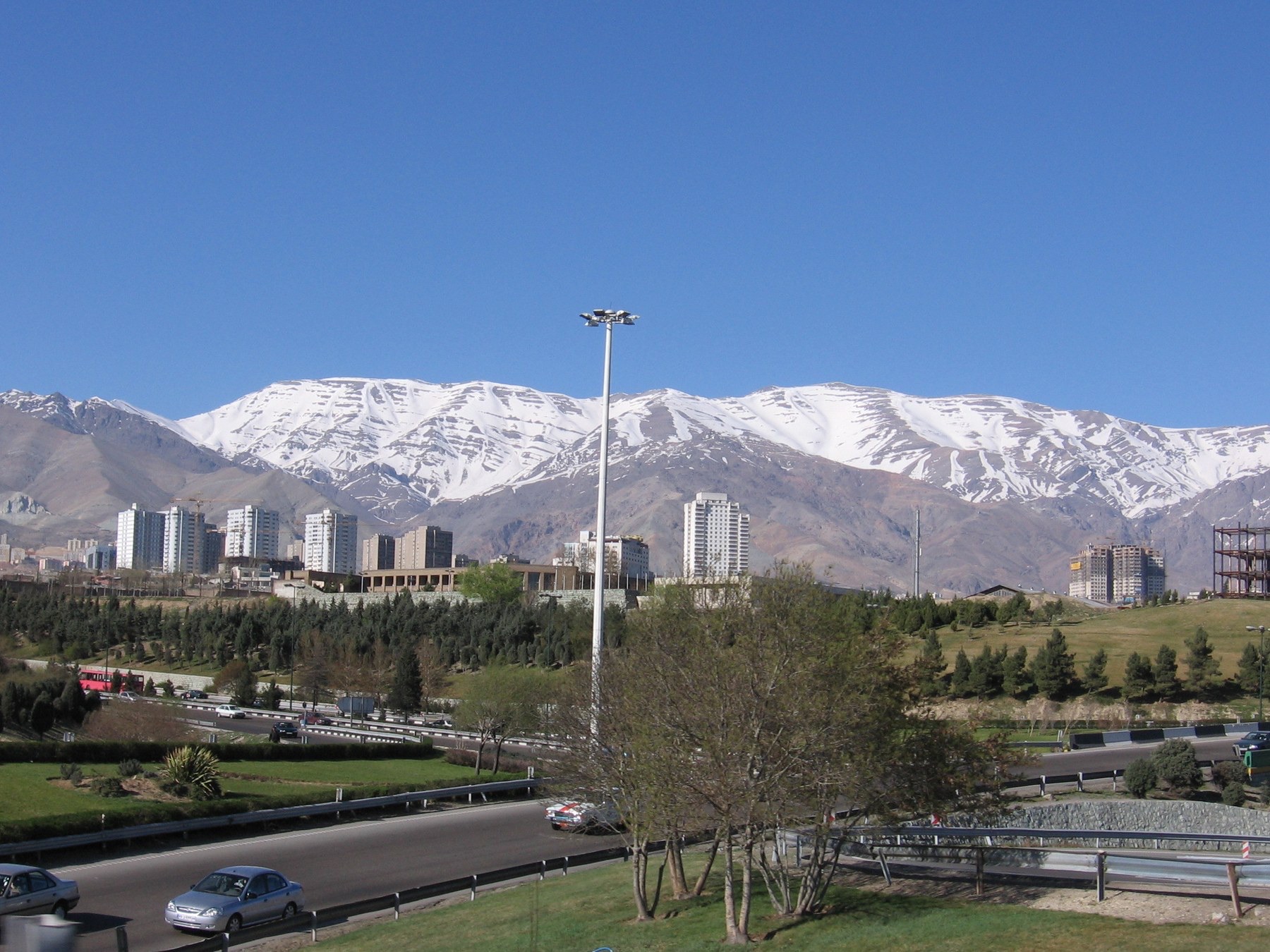
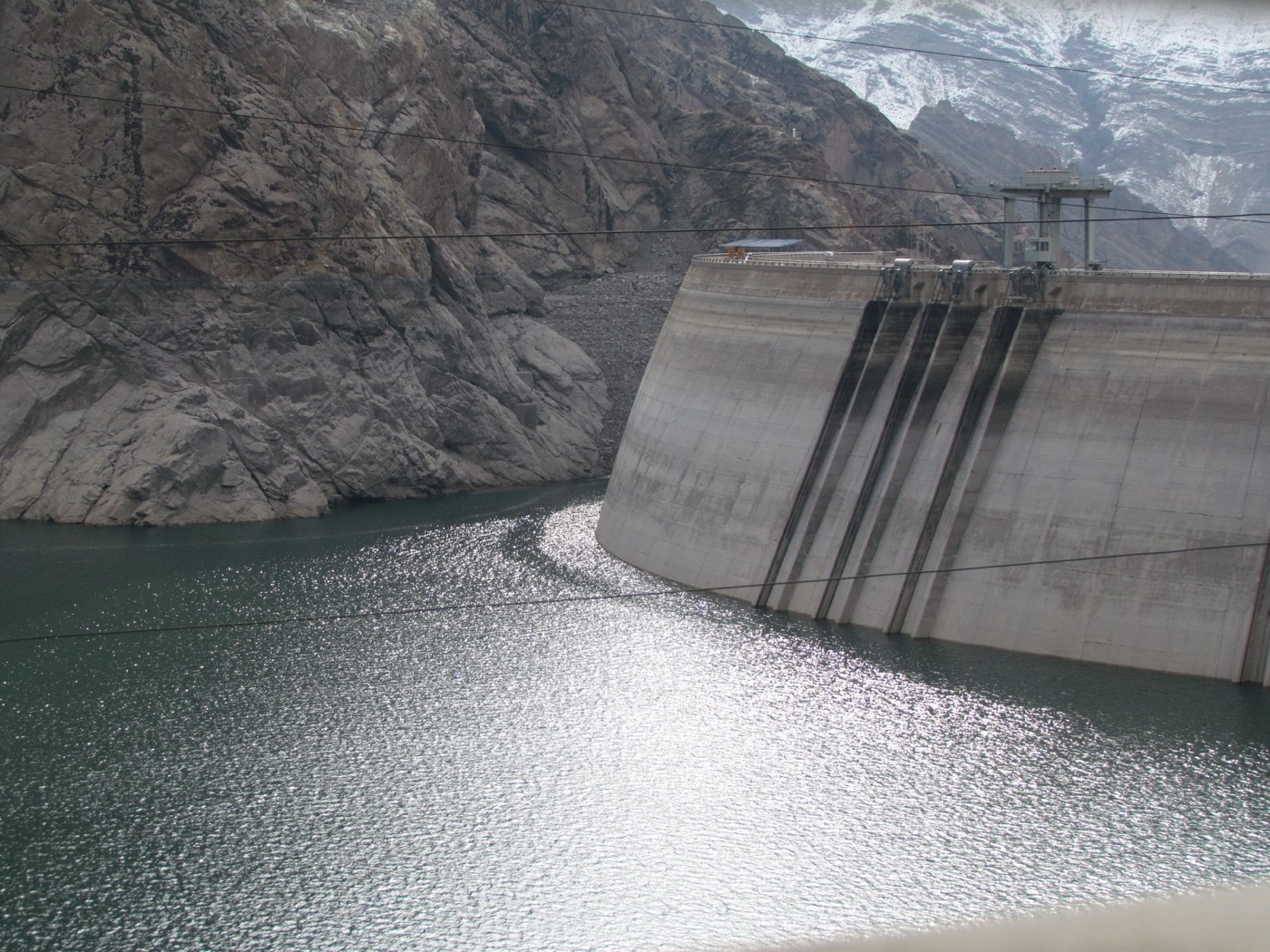
From almost any street in Tehran, on a clear day, the Alborz mountains fill the northern sky, and for half the year their upper slopes are white. The snow is the city's water. It melts through the spring into rivers that come down through the gorges, the Karaj, the Jajrud, the Lar, and the rivers are held in five dams that the city built between the 1960s and the 2000s to store the melt for the dry summer. Below the dams the water is treated and piped to nine million people, and what the dams cannot give, the wells make up, from an aquifer under the plain that has been pumped for a century.
In the autumn of 2025, after seven years of drought, the five dams held less than a fifth of what they were built to hold, one of them was near its dead volume, and the officials who had spent a decade saying the city would manage said, instead, that it might have to be rationed by district, and that the capital might one day have to move. This article is about how the capital of a mountain country came to that, and it is a story of a drought landing on a country that had already spent its water.
The mountain and the plain
Tehran lies at the foot of the Alborz, at about 1,200 metres in the north of the city and 900 in the south, on an alluvial fan of gravel that the rivers laid down over ages. The gravel holds water, and for most of the city's history that water was reached by qanats, the underground channels that Persia invented three thousand years ago, which tapped the aquifer at the foot of the mountains and carried it by gravity to the gardens and cisterns of the city. The qanats supplied Tehran into the twentieth century. The dams replaced them, and the pumps replaced both.
| Tehran's water | |
|---|---|
| Population | About 9 million in the city, 15 in the province |
| Sources | Five dams on Alborz rivers, and groundwater from about 500 municipal wells and many more private ones |
| Share from groundwater | Around a third in a normal year, over half in a dry one |
| Rainfall | About 230 millimetres a year, falling |
| Reservoir storage, autumn 2025 | Under a fifth of capacity |
| Subsidence, south west Tehran | Up to 25 centimetres a year |
The five dams, Amir Kabir on the Karaj, Latyan on the Jajrud, Lar in the high mountains, Taleghan to the west and Mamloo to the east, hold about two billion cubic metres between them when full. The city uses about a billion a year. In a wet decade the arithmetic works. In a dry one the reservoirs draw down, the wells run harder to fill the gap, and the water table drops.
The country's water
Tehran's shortage is Iran's, and Iran's is the clearest case in this series of a country choosing to spend its water. From the 1980s, under a policy of self sufficiency in food, the country dammed nearly every river it had, more than six hundred dams in forty years, and subsidised farmers to grow wheat, rice and sugar beet on irrigated land across a plateau that receives, on average, a third of the world's rainfall. Ninety percent of the country's water goes to agriculture, at efficiencies that the government's own reports put among the lowest in the world, and the aquifers that feed it have been pumped by hundreds of thousands of wells, a large share of them unlicensed, to the point where the ground across the country's plains is sinking and the wells of whole provinces have turned saline.
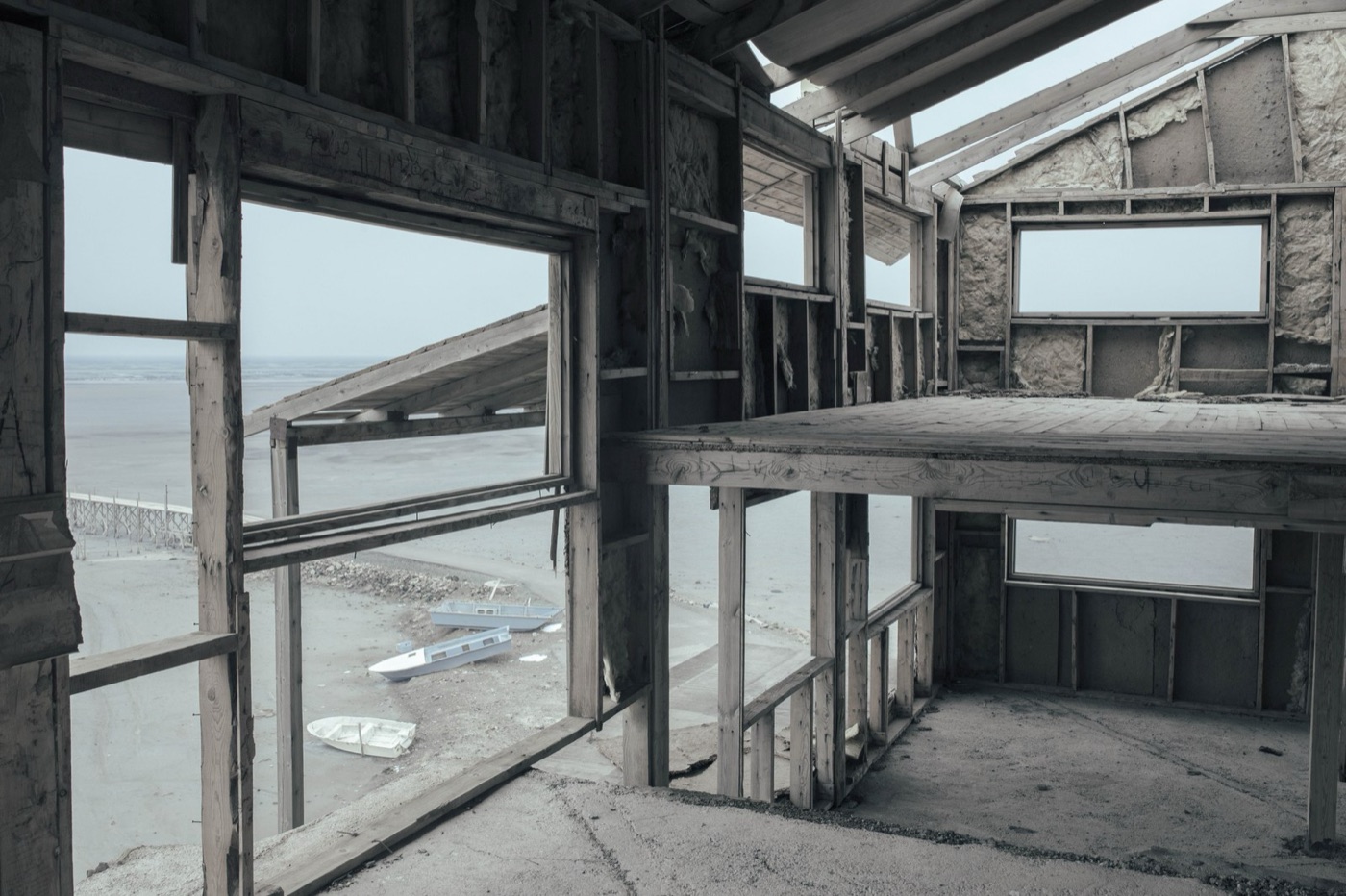
The picture of it is Lake Urmia, in the north west, which was the largest lake in the Middle East and which, between the 1990s and the 2010s, lost about ninety percent of its water to the dams and wells on the rivers that fed it, leaving a salt flat whose dust blows across the surrounding farms. Scientists named the process Aral Sea syndrome, after the lake in that article, and it is the same disease: a lake spent on irrigation, deliberately, in a dry country, by a state that did the sums and chose the crop. In the south west, in Khuzestan, the diversion of rivers to farms and to other provinces left the marshes dry and the towns without water, and in the summer of 2021 the province rioted over it.
| Iran's water, in short | |
|---|---|
| Share to agriculture | About 90 percent |
| Dams built since the 1980s | Over 600 |
| Lake Urmia, loss of water | About 90 percent |
| Groundwater | Overdrawn in most plains; widespread subsidence |
| Rainfall trend | Falling; 2021 to 2025 among the driest on record |
The sinking city
Tehran's plain is subsiding, and in its south western suburbs, where the wells are densest and the sediment softest, the rate measured by satellite is up to 25 centimetres a year, which puts the district among the fastest sinking on Earth, alongside the Jakarta and Mexico City of their own articles. The cause is the same: water pumped from the ground faster than the mountains refill it. The effects are the same: cracked buildings, broken mains, and a fissure that runs across the plain and has reached the runways of the international airport and the line of the railway to the south. The subsidence is recent, in the scale of this series, and it has accelerated with the drought, as the wells have run harder to replace the dams.
The drought
The years from about 2018 were the driest sequence in Tehran's records, with several winters at half the normal snowfall on the Alborz and a warming that melts what falls earlier and evaporates more of it from the reservoirs. Through 2024 and 2025 the five dams fell below a fifth of capacity, Amir Kabir and Latyan close to their dead volumes, and the utility cut the pressure at night, which, as in São Paulo, meant the upper floors and the higher districts had no water for hours. The government announced a plan to ration by district, appealed to the city to cut its use by a fifth, and, in November 2025, the president raised the possibility, which had been discussed for decades, of moving the capital to the coast. Rain returned that winter, as it has in every city in this series, and the talk subsided, as it does.
The city's response to date has been the one the country's has always been, which is to build. A new dam on a river to the east, a pipeline from the Caspian over the mountains, desalination on the Gulf and a pipeline a thousand kilometres north across the plateau, all proposed, some begun, and each of them a way of adding supply to a city that has not yet reduced its demand or fixed its pipes, which lose, by the utility's own estimate, around a quarter of what they carry.
The qanats
It is worth pausing on what Tehran had before the dams, because it is the one technology in this article that took only what the mountain gave. A qanat is a gently sloping tunnel, dug by hand from the foot of the mountains into the alluvial fan, that intercepts the water table and carries the water out to the surface by gravity, kilometres away, without a pump. The shafts that were dug to build and clean it dot the desert in lines, like a string of craters, across Iran and the countries the technique reached, from Morocco to western China. A qanat cannot overdraw its aquifer, because it flows only as fast as the water table feeds it, and when the table falls the qanat dries, which is a signal that a pump ignores. Tehran had hundreds; most of them dried in the twentieth century as the wells around them drew the water table below the tunnels, and the few that still flow water the old gardens of the north of the city. The country that invented the sustainable well replaced it with the unsustainable one, and the plain's subsidence is the measure of the difference.
What could be done
The answers exist and they are the ones this series has found in every city with the same problem. Tehran's sewage, from nine million people, is treated at a set of plants in the south that were built in the 2000s, and most of the treated water is used for irrigation in the farms below the city, which is good, and little of it is reused in the city itself, which is where the parks, the industry and, in time, the aquifer could take it. The network's leaks are a supply as large as one of the dams. The tariff for water is among the lowest in the world, subsidised so heavily that the city's residents use more per head than most of Europe, and a price that reflected the cost would cut demand faster than any dam could add to it. And above all, the farms on the plain around the capital that pump the same aquifer, growing wheat and fodder on water the city needs, are the largest lever there is and the one no government has been willing to pull.
What it teaches
Tehran is the city in this series where a drought fell on a country that had already spent its water, and it shows the difference between the two. The drought is weather, and it will pass and return. The spending is policy, fifty years of dams, wells and subsidised wheat in a desert, and it does not pass. A capital under a snow covered mountain range ran short because the rest of the country had been managed as if the mountains were infinite, and the capital's answer, so far, has been to propose more of the same. The lake to the north west is the picture of where that goes.
Five dams, under a fifth full, at the foot of a mountain with snow on it.
Sources
- Tehran Regional Water Company and Iran's Ministry of Energy: reservoir levels at Amir Kabir, Latyan, Lar, Taleghan and Mamloo, 2021 to 2025, and the share of supply from groundwater.
- Haghighi, M.H. and Motagh, M. (2019). Ground surface response to continuous compaction of aquifer system in Tehran, Iran. Remote Sensing of Environment 221. Subsidence rates up to about 25 centimetres a year.
- Madani, K. (2014). Water management in Iran: what is causing the looming crisis? Journal of Environmental Studies and Sciences 4.
- AghaKouchak, A. et al. (2015). Aral Sea syndrome desiccates Lake Urmia. Journal of Great Lakes Research 41.
- Reporting by Reuters, the BBC and IranWire on the 2021 Khuzestan water protests and the 2024 to 2025 Tehran reservoir crisis.
- Photographs: opener: Tehran-Alborz-March 2006 by No machine-readable author provided. She (CC BY-SA) via Wikimedia Commons; inline: Karaj dam - panoramio (2) by amir nakhaei (CC BY) via Wikimedia Commons; inline: Solmaz Daryani Urmia lake7 by SolmazDaryani (CC BY-SA) via Wikimedia Commons.