Thirsty Places: The Murray Darling
Australia's largest river system grows most of the country's irrigated food, and for a century the states along it took more water than the rivers had. A drought that lasted a decade, a river mouth that had to be dredged to reach the sea, and a million dead fish forced the country to write a plan that buys water back from farmers and gives it to the river. What the Murray Darling Basin Plan is, why it is the world's largest experiment in water markets, and what it has and has not fixed.
At the mouth of the Murray, where Australia's longest river reaches the Southern Ocean through a gap in the dunes, there is a dredge. It has been working, on and off, since 2002, because without it the river does not reach the sea. The water that would have pushed the sand out of the channel has been taken, upstream, by the farms of four states, and in the drought of the 2000s the flow fell so far that the lakes behind the mouth dropped below sea level, the soils beneath them dried and turned to sulphuric acid, and the mouth closed. The dredge keeps it open. It is, in its way, the most honest piece of water infrastructure in the country.
This article is about the Murray Darling Basin, a seventh of Australia and the source of most of its irrigated food, and about the plan the country wrote to give some of the river back. It is the largest water market in the world and the largest deliberate transfer of water from farms to a river, and its story is the story of every over allocated basin on this site, told with the numbers written down.
A basin shared four ways
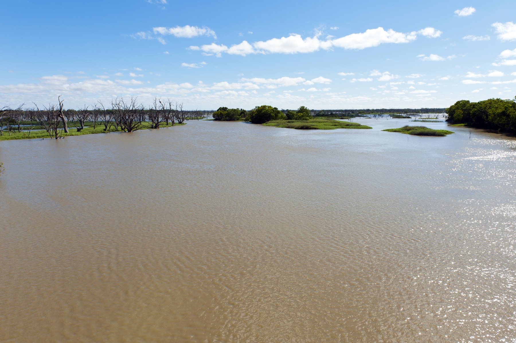
The Murray and the Darling and their tributaries drain more than a million square kilometres of inland eastern Australia, from Queensland through New South Wales and Victoria to the Murray's mouth in South Australia. The rivers are long, slow and, for an area that size, small: the whole basin's average flow is a fraction of the Rhine's, and it varies from year to year more than any comparable river system on Earth. Some years it floods. Some years the Darling stops flowing altogether, and did so long before anyone irrigated from it.
Irrigation began in the 1880s and grew through the twentieth century, as the states built dams on the headwaters and licensed farmers to take water from the regulated rivers below them, for wheat, then rice and cotton, then fruit, vines and dairy. Each state licensed its own farmers, on its own reckoning of the river, and the sum of the licences, by the 1990s, exceeded what the rivers could give in a normal year and far exceeded what they could give in a dry one. The basin was over allocated, in the technical sense that if every licence were used the river would run backwards.
| The Murray Darling Basin | |
|---|---|
| Area | About 1 million square kilometres, a seventh of Australia |
| Share of Australia's irrigated farmland | About two thirds |
| Share of the country's food production | About 40 percent |
| Average water taken for irrigation, before the plan | Around 13,000 to 14,000 gigalitres a year |
| The plan's recovery target | 2,750 gigalitres a year, plus 450 through efficiency |
| A gigalitre | A billion litres, about 400 Olympic pools |
The drought
The Millennium Drought ran, in the southern basin, from about 1997 to 2009, and it was the longest and deepest in the country's records. Inflows to the Murray fell to a fraction of the average for years at a time. The storages emptied. Adelaide, at the end of the system, came close to losing its supply and built a desalination plant. Irrigators in the southern basin received, in the worst years, a few percent of their allocations, and the dairy and rice industries shrank by more than half. The floodplain forests of river red gum along the Murray, which need a flood every few years, went a decade without one and began to die. And at the mouth, the lakes acidified and the dredge arrived.
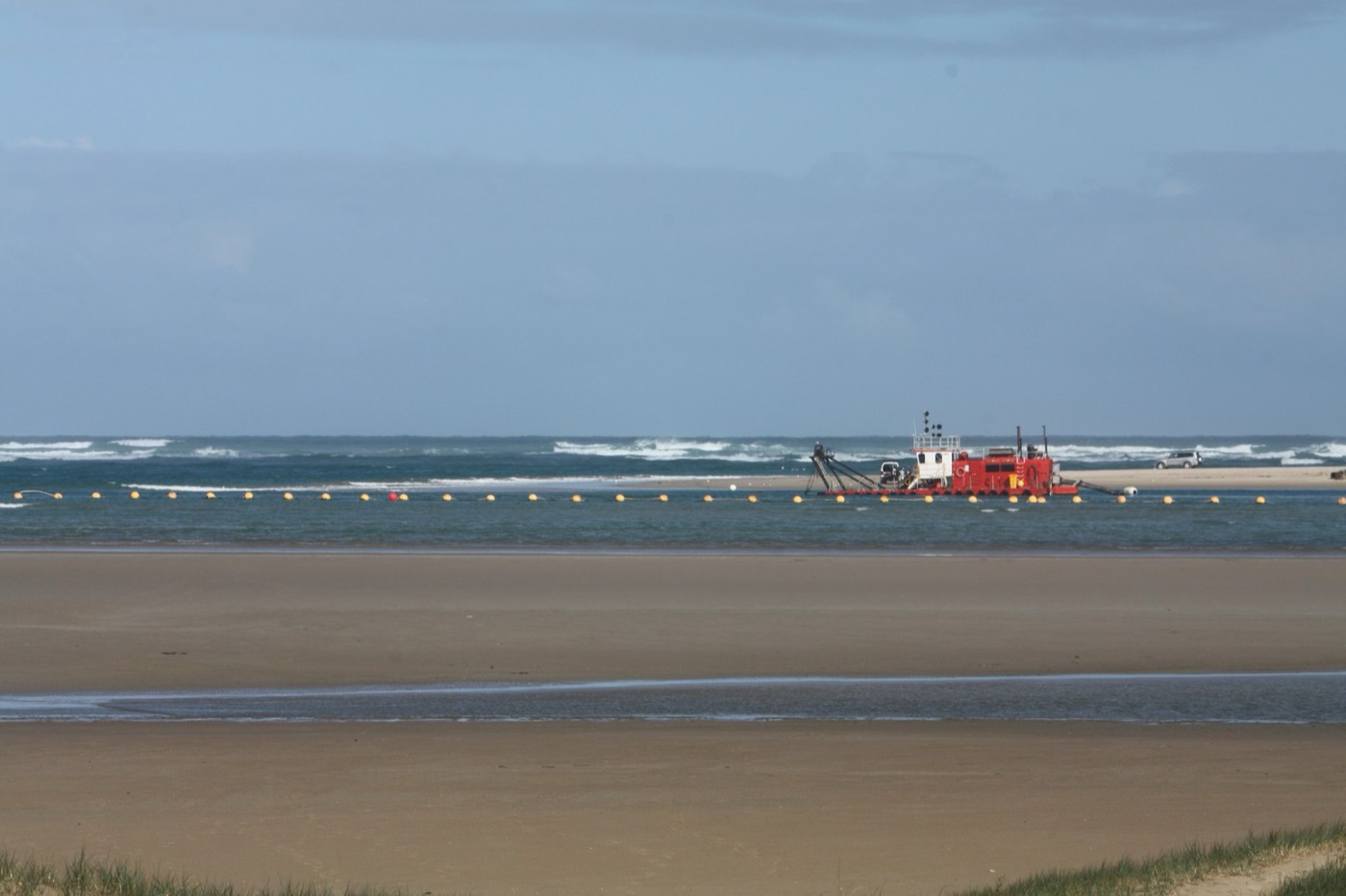
The drought made visible what the licences had hidden, which is that the basin had been sharing out water it did not have. It also made possible what the politics had prevented, which is a national plan.
The plan
The Commonwealth took over the basin's management from the states in 2007, in the middle of the drought, and in 2012 it published the Basin Plan. The plan did two things. It set a limit, called the sustainable diversion limit, on how much water could be taken from each river and each aquifer in the basin. And it undertook to bring the actual take down to that limit by recovering 2,750 gigalitres a year, about a fifth of what irrigation had been taking, and returning it to the rivers as environmental water, to be released for the forests, the wetlands, the fish and the mouth by a new agency created to hold it.
The recovery was to happen in two ways, and this is what makes the basin a case for the world. The first was to buy water on the market. Australia had, since the 1990s, separated water rights from land, so that a farmer's entitlement to a share of the river could be sold, leased or traded like any other asset, and a market had grown in which a rice grower who could not use his water in a dry year would sell it to a vineyard that could. The Commonwealth entered that market as a buyer, with public money, and bought entitlements from farmers who chose to sell, at the market price, for the river. The second was to pay for irrigation works, lined channels, drip systems, automated gates, that let a farm grow the same crop with less water, and to take the saving for the river.
| Recovering the water | |
|---|---|
| Buying entitlements on the water market | Cheaper per gigalitre; opposed by irrigation towns that lose farms |
| Paying for efficiency works on farms | Two to three times the cost; favoured by the states and the towns |
| Recovered by 2023 | Around 2,100 gigalitres of the 2,750, most of it by purchase |
| The extra 450 gigalitres | Tied to efficiency measures; a small fraction delivered |
| Where the water is held | The Commonwealth Environmental Water Holder, for release to rivers and wetlands |
The market
A water market is a strange thing to most people and worth describing, because the basin's is the largest in the world and the plan depends on it. A farmer in the southern basin holds an entitlement, a permanent right to a share of the river, and each year receives an allocation against it, a percentage that the state sets according to how much water is in storage. Both can be traded. An entitlement is sold like land, permanently, and its price runs to thousands of dollars a megalitre. An allocation is sold for the season, to a neighbour or to a stranger three hundred kilometres away, at a price that in a wet year is close to nothing and in the drought of 2019 reached several hundred dollars a megalitre. The trades run through a register, and the water moves, physically, by the river operator releasing it from the dam at a different time or to a different offtake. The effect, over thirty years, has been that water flows to the crops that earn most from it, that a drought is priced rather than rationed, and that a government wanting water for a river can buy it from a willing seller instead of taking it. The effect has also been that the small farms sold and the almonds arrived, which is the argument the towns make.
What it fixed
A decade on, the plan has recovered most of its target, and the water is being used. The environmental water holder releases flows to the red gum forests, the Coorong at the mouth and the wetlands of the mid Murray, on a schedule that mimics the floods the river used to have, and monitoring shows fish breeding, forests recovering and bird colonies returning where the water reaches. The mouth is open, though the dredge is still there. And the market has done what markets do: water has moved, in dry years, from low value crops to high value ones, from rice and dairy to almonds and vines, at prices that reached, in the drought of 2019, levels that made headlines and bankruptcies.
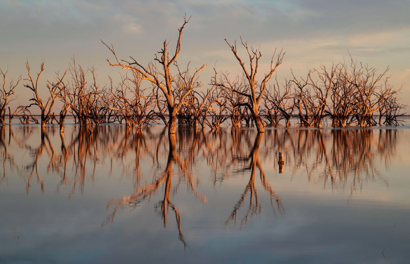
It has been, in the terms of this series, a partial success, and it has been achieved by the least glamorous means on the site: a number, a limit, a purchase, and a register.
What it did not fix
The plan's critics are on both sides, and both have a case.
The irrigation towns of the southern basin, which lost farms when the entitlements were sold, argue that the buybacks hollowed them out, and the states that speak for them have shifted the recovery, wherever they could, to the more expensive efficiency works, which keep the farms and deliver less water. The 450 gigalitres tied to those works had, ten years on, barely begun, and the deadline was extended to 2027 with a return to purchasing.
The scientists and the downstream state argue that the target itself was a political number, lower than the river needs, and that the plan has been weakened by the states in its implementation. The floodplain forests that need high flows to flood have not received them, because the water cannot be delivered over the banks without flooding farms in between. The Darling, in the north, where the rules on taking floodwater were looser and the compliance weaker, ran dry in the drought of 2018 to 2019, and in the summer of 2019 an estimated million fish, including Murray cod a century old, died in the stagnant pools at Menindee in three events over a few weeks. The inquiry found the causes in the drought, the heat, and the extraction upstream that had left the river with no flow to carry it through. It was the plan's most visible failure, and it happened in the part of the basin where the plan had been least applied.
And through all of it runs the climate. The basin's inflows are falling as the south of the continent dries, and a plan built on the record of the twentieth century is sharing out a river that the twenty first is shrinking. The limits will have to fall again, and the argument about who bears the fall has only begun.
What it teaches
The Murray Darling is the basin in this series that wrote its arithmetic down. It measured what the rivers had, admitted that the licences exceeded it, set a limit, and paid, in public money and in farms, to bring the take below the limit, using a market that let the farmers who wanted to sell decide. It is the model that California's groundwater law, the Colorado's negotiations and the Aral's sad canals all point towards, and it has been messier, slower and more contested than its architects hoped, and it has, unlike the others, actually moved water from the fields back to the river.
2,750 gigalitres, bought back a farm at a time, and a dredge at the mouth that still has work to do.
Sources
- Murray Darling Basin Authority (2012). Basin Plan, and the annual Basin Plan reports on water recovery against the 2,750 gigalitre target and the 450 gigalitre efficiency measures.
- Australian Academy of Science (2019). Investigation of the causes of mass fish kills in the Menindee region NSW over the summer of 2018 to 2019.
- Productivity Commission (2018 and 2023). Murray Darling Basin Plan: five year assessment and implementation review.
- Grafton, R.Q. and Wheeler, S.A. (2018). Economics of water recovery in the Murray Darling Basin. Annual Review of Resource Economics 10.
- CSIRO (2008). Water availability in the Murray Darling Basin: the Sustainable Yields project, and the Millennium Drought record.
- Photographs: opener: Menindee Lakes viewed from the Main Weir by Jeremy Buckingham (CC BY) via Wikimedia Commons; inline: Keeping the Murray mouth open by Mundoo (CC BY-SA) via Wikimedia Commons; inline: Sunset Menindee Lakes - Flickr - Rmonty119 by Robert Montgomery (CC BY) via Wikimedia Commons.