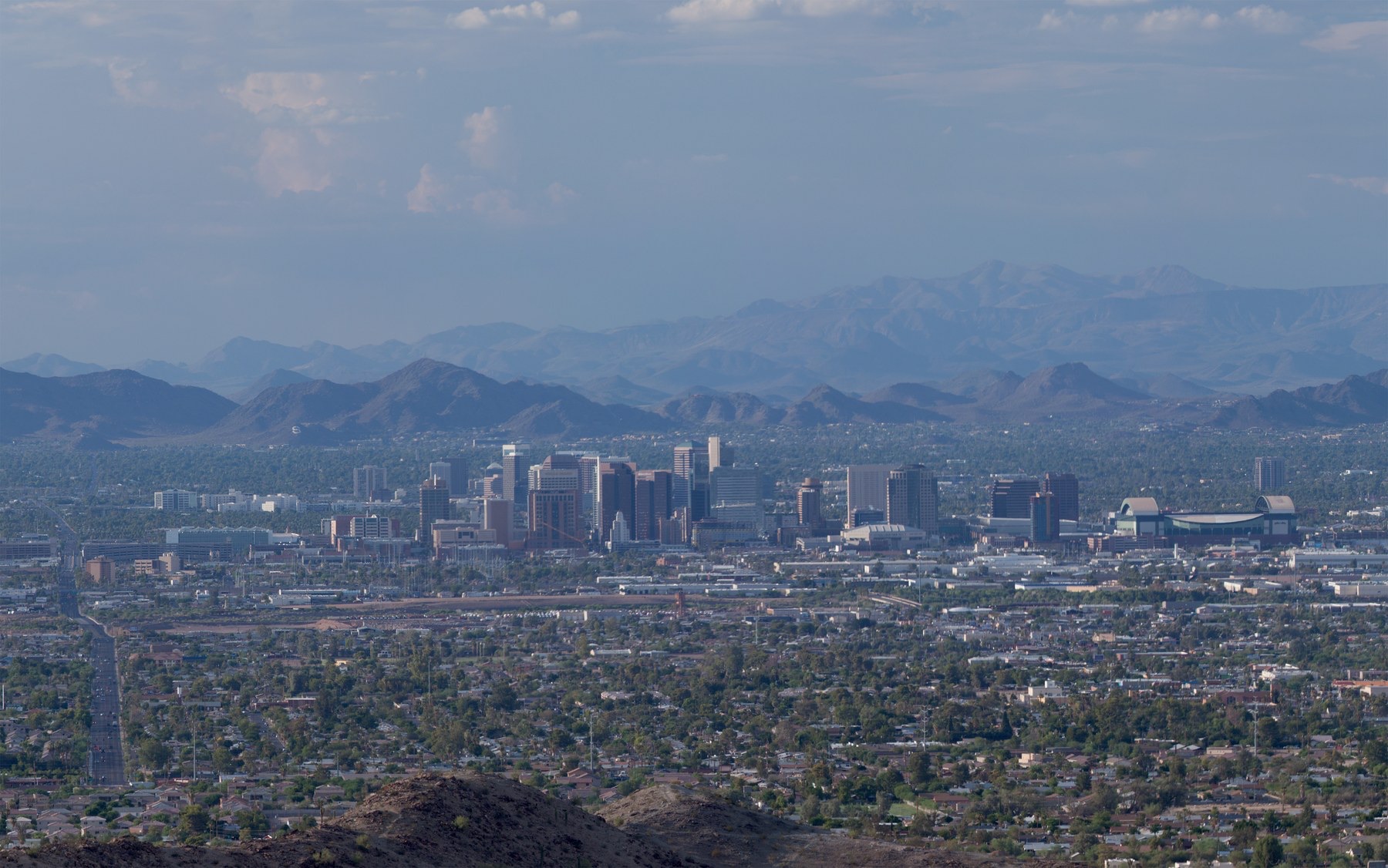
Thirsty Places: Phoenix
Five million people live in a desert valley that reaches fifty degrees in summer, on a river that stopped reaching the city a century ago, a canal from the Colorado five hundred kilometres long, and an aquifer they have been told, by law, they must not empty. In 2023 the state stopped approving new housing on groundwater in parts of the valley. What Phoenix's water is, why it is better managed than its reputation, and what the Colorado's decline means for the fastest growing city in America.
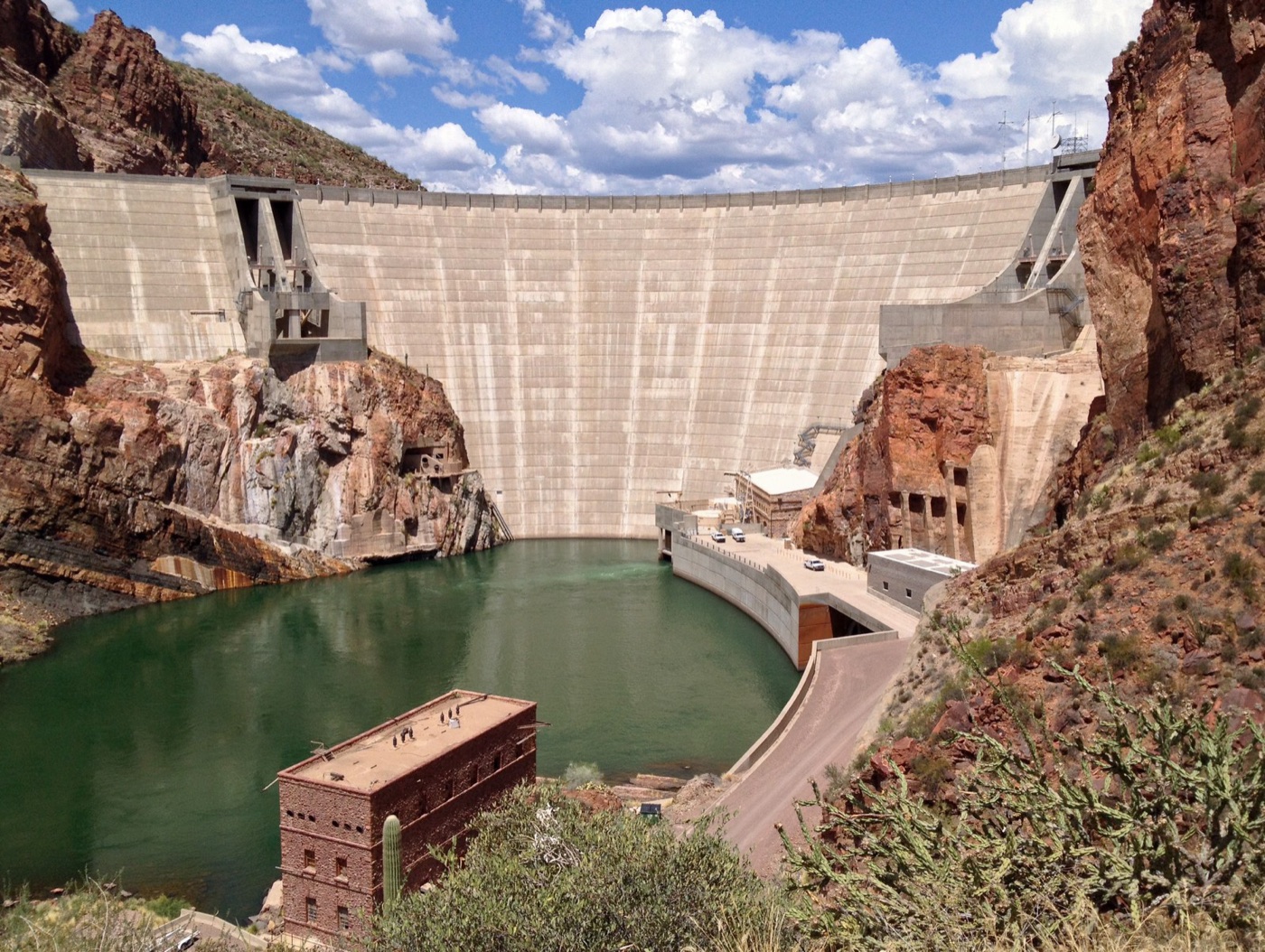
The Salt River runs through the middle of Phoenix and there is no water in it. The riverbed is a wide gravel channel lined with freeways and, in places, made into a lake by inflatable dams for a lakeside development, and the river itself is held back in a chain of reservoirs in the mountains to the east, behind a dam that was finished in 1911 and that made the valley a farm and then a city. Five million people live in the valley now, in the Sonoran Desert, with about two hundred millimetres of rain a year and summers that reach fifty degrees, and their water is a canal from a river in another state, an aquifer beneath the city, and a law.
This article is about a city that, by the reputation it carries, should not exist, and that has managed its water more carefully than most of the places in this series, and about what happens to that management when the river it depends on delivers less.
Three sources
Phoenix has three waters, and the order they arrived in is the order of the story.
The first is the Salt and Verde rivers, which drain the high country of central Arizona and which the federal government dammed from 1911 onwards to irrigate the valley. The reservoirs hold about two and a half billion cubic metres, and the system, run by an association of the original farms that is now a utility, still supplies about a third of the metropolitan area, through canals that follow the lines of the ones the Hohokam people dug across the same valley a thousand years ago.
The second is the ground. Under the valley is a deep aquifer of gravel that the city and its farms pumped hard from the 1940s, and by the 1970s the water table under parts of the valley had fallen by a hundred metres and the ground had cracked in fissures across the desert. That is the water the law was written for.
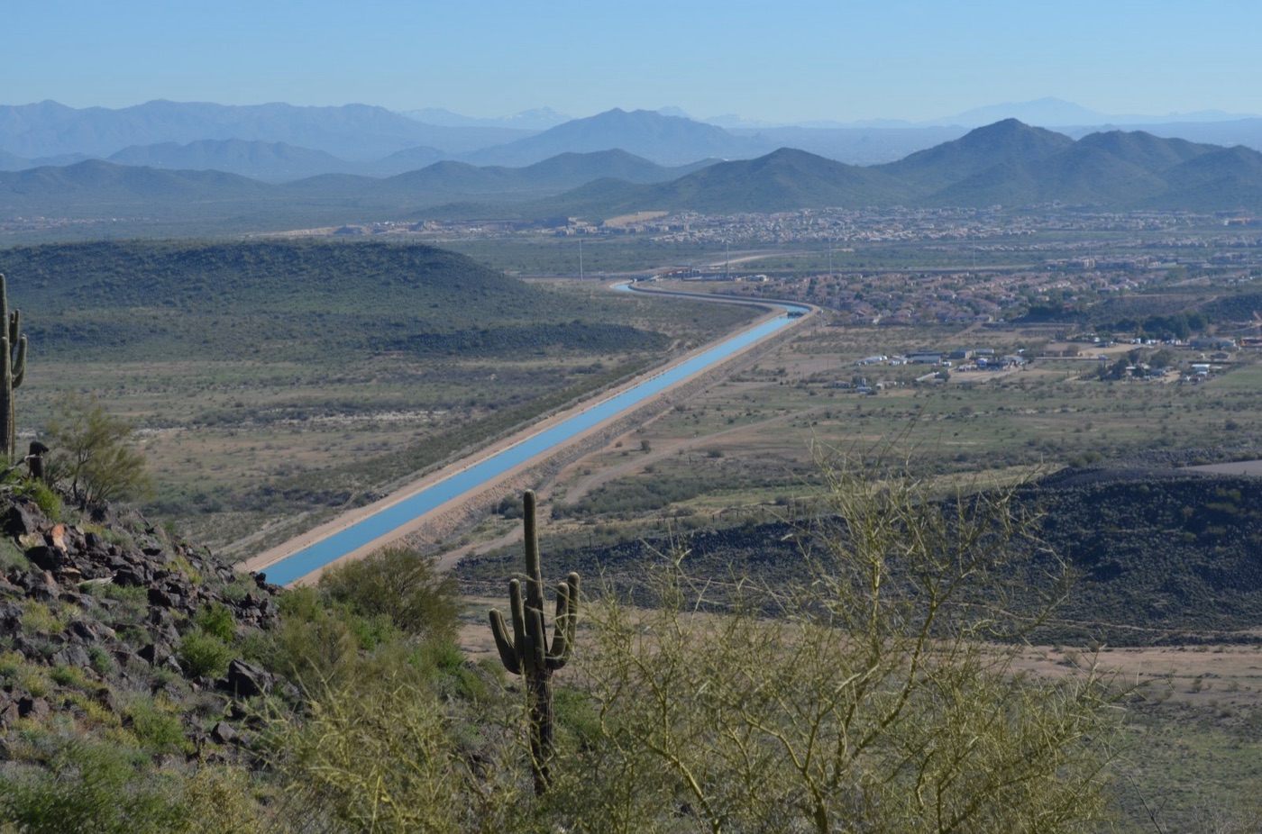
The third is the Colorado. The Central Arizona Project, argued over for forty years and built between 1973 and 1993, lifts water from Lake Havasu on the river and carries it 541 kilometres east and south across the desert, through a concrete canal and fourteen pumping stations that raise it nearly nine hundred metres, to Phoenix and on to Tucson. It delivers about a third of the valley's water in a normal year, and it is the source that the rest of this article is about, because it is the one that is going.
| Phoenix's water | |
|---|---|
| Population, metropolitan area | About 5 million |
| Rainfall | About 200 millimetres a year |
| The Salt and Verde rivers, dammed since 1911 | About a third of supply |
| The Central Arizona Project canal, since the 1990s | About a third |
| Groundwater | The rest, limited by law |
| Colorado River cut to Arizona, 2023 | About 592,000 acre feet, a fifth of the state's share |
The law
In 1980 Arizona did something that California did not do until 2014 and most of the world has not done at all. It passed a law regulating groundwater. The Groundwater Management Act created management areas around Phoenix, Tucson and the other pumping centres, set a goal of safe yield, pumping no more than the aquifer receives, by 2025, and, in the provision that has mattered most, required that any new subdivision in those areas prove, before a lot could be sold, that it had an assured supply of water for a hundred years. A developer could not build on a well and hope. The rule pushed the cities onto renewable supplies, the rivers and the canal, and it made the aquifer a reserve rather than a source, which is what allowed Phoenix to grow by three million people in forty years without emptying the ground beneath it.
The law also created the bank. Since the 1990s Arizona has taken Colorado River water it did not need in a given year and spread it in basins in the desert to soak into the aquifer, banking it against the shortages it expected, and it has stored about four million acre feet, several years of the canal's deliveries, underground. It is the largest deliberate aquifer recharge in the world, and it is the reason the cuts of 2022 and 2023 were absorbed without anyone's tap running dry.
| Arizona's water law, in short | |
|---|---|
| Groundwater Management Act | 1980; safe yield goal, pumping limits, assured supply rule |
| Assured supply | A hundred years of water proved before a subdivision is approved |
| Water banking | About 4 million acre feet stored underground since 1996 |
| June 2023 | State finds the Phoenix area's groundwater fully allocated; no new subdivisions on wells |
| What it did | Let the city grow on rivers and the canal while the aquifer was held in reserve |
The junior right
The catch is the canal's place in the queue. When Arizona won the Colorado water for the project in 1968, California, which had opposed the project for decades, extracted a price: Arizona's canal water would hold the most junior right on the lower river, to be cut first and cut entirely before California lost a drop. For thirty years of full reservoirs the clause did not matter. Since 2000 the Colorado has delivered about a fifth less than the compact assumed, Lake Mead, described in the Las Vegas article, fell to its lowest level since it was filled, and in 2022 and 2023 the federal government declared shortages that cut Arizona by about a fifth of its share, all of it from the canal. The farms in central Arizona that held the lowest priority within the project lost their canal water altogether, and went back to their wells or fallowed their fields.
The cities were spared, because the cities hold the higher priority within the canal and because the bank was there. The next round of cuts, being negotiated among the seven states for the years after 2026, will be deeper, and they will reach the cities, and Phoenix's plan for that is the aquifer it has spent forty years not using.
June 2023
The clearest sign of the limit came in June 2023, when the state's water department published a model of the Phoenix area's aquifer and found that, over the coming hundred years, the water already promised to existing users and approved developments exceeded what the aquifer could supply by about four percent. Under the 1980 law that meant no new subdivision could be approved on groundwater alone. Developments with a renewable supply, river water or reclaimed water or canal water they had bought, could proceed. Developments on the desert edge that had planned to drill could not, and the announcement stopped several of them. The city did not run out of water. It ran out of unallocated water, which is what a law of that kind is for, and it was, in the terms of this series, the system working as designed, to the loud objection of the people it stopped.
The farms
The valley's water was farms before it was houses, and the farms are still where the arguments are. Central Arizona's cotton, alfalfa and citrus were the reason the canal was built, and the farmers were given the lowest priority within it in exchange for cheap water in the early years, on the understanding that as cities grew the farms would give way. That is what has happened, in the cuts of 2022 and 2023, and it has happened faster than the farmers expected, so that fields in Pinal County that had canal water in 2021 had none in 2023 and went back to wells or to dust. Elsewhere in the state, outside the managed areas, groundwater is still unregulated, and the farms of the rural valleys, some of them growing alfalfa for export to dairies in the Gulf, pump without limit, which is the argument the state legislature has failed to settle for a decade. The pattern is the Murray Darling's: the water moves from the fields to the cities, the fields object, and the aquifer under the fields, where nobody is counting, is the one that is spent.
What the city does with what it has
Phoenix and its suburbs have, less visibly than Las Vegas, done the same things. Per person use has fallen by about a third since the 1990s, through pricing, through desert landscaping replacing lawns in the newer suburbs, and through a rule that new golf courses and parks use reclaimed water. The city's sewage is treated and most of it reused, for the cooling towers of the nuclear plant west of the city, the largest in the country, which is the only nuclear plant in the world cooled entirely by treated sewage; for farms; and for the aquifer, where it is spread in basins and stored. And the utilities have bought water from farms on the Colorado, paid tribes to lease their river rights, and studied, with the rest of the basin, the desalination plants on the Gulf of California that would, at a price, add a source that does not depend on snow in Colorado.
What none of that changes is the arithmetic of the canal. A third of the valley's water comes from a river that is shrinking, under a right that is cut first, and the reserve that covers the gap is finite. The state's answer, so far, has been the same as every other city's in the American west, which is to hold the line on growth, buy what water can be bought, and wait for the seven states to agree on a river that the climate is making smaller.
What it teaches
Phoenix is the city in this series that wrote its limits into law before the crisis and has been living inside them since, which makes it, against its reputation, one of the better managed in the American west. The law kept the aquifer as a reserve, the bank filled it, and the assured supply rule stopped the city building on water it did not have. What the law could not do was make the Colorado deliver, and the valley's next decade is a test of whether a city can shrink its most junior source by a third and grow at the same time. The rest of the basin is watching, because the rest of the basin is next.
541 kilometres of canal, four million acre feet in the ground, and a river in another state that is deciding both.
Sources
- Central Arizona Project, system facts: 336 miles of canal, about 1.5 million acre feet a year, and the priority structure under the 1968 Colorado River Basin Project Act.
- Arizona Department of Water Resources, Groundwater Management Act (1980), Active Management Areas, and the June 2023 Phoenix AMA groundwater model and the pause on new assured water supply determinations.
- US Bureau of Reclamation, 2022 and 2023 Colorado River shortage declarations: Arizona's reductions of 512,000 and 592,000 acre feet.
- Salt River Project, history of the Roosevelt Dam and the Salt and Verde river system.
- Arizona Water Banking Authority, stored credits of about 4 million acre feet.
- Photographs: opener: Downtown Phoenix Skyline (6974043971) by Alan Stark from Goodyear, AZ, United Sta (CC BY-SA) via Wikimedia Commons; inline: CAPCanal.2013 by Onel5969 (CC BY-SA) via Wikimedia Commons; inline: Roosevelt Dam, Arizona by Nicholas Hartmann (CC BY-SA) via Wikimedia Commons.