Plain Water: Groundwater
Almost all of the fresh water on Earth that is liquid and not in a lake is underground, and the world pumps about a thousand cubic kilometres of it a year, a third of what it uses, and puts back less. What an aquifer is and how it fills, why a well is a loan and how much of the world is living on one, what the satellites saw, where the ground is sinking, and why the water under a field is the hardest water on this site to govern.
Almost all of the fresh water on Earth that is liquid and not in a lake is underground. It fills the spaces between grains of sand and gravel, the cracks in sandstone and limestone and, in a few places, caverns, and it is called an aquifer when there is enough of it, close enough to the surface and in rock porous enough, for a well to draw on. The world pumps about a thousand cubic kilometres of it a year, which is about a third of all the fresh water it uses and about half of what it drinks, and in the dry regions where the pumping is heaviest it pumps faster than the rain refills. The difference is the water table falling, and it is falling, by the satellites' measure, across every major farming region on Earth.
This article is about what an aquifer is and how it fills, who pumps it and for what, what the satellites saw, where the ground has sunk, and why the water under a field is the hardest water on this site to govern.
What an aquifer is
Rain that falls on the ground either runs off into a river, evaporates, is taken up by plants, or soaks down through the soil until it reaches a depth where every pore is full. That depth is the water table, and everything below it is groundwater, moving slowly, a few metres a year, through the rock toward the nearest river, spring or sea. An aquifer is a layer where the rock is porous enough to hold a lot and permeable enough to give it up to a well: the sands and gravels of a river plain, the sandstones of a basin, the limestone of a karst. Under a river plain the water table may be a few metres down and fill every wet season; under a desert basin it may be hundreds of metres down and fill at a millimetre a year from rain that fell on distant hills.
The recharge is the number that matters. An aquifer that fills at a hundred millimetres a year across its area can be pumped at that rate forever, and pumped at twice that rate it is being emptied, however large the stock. Most of the world's heavily pumped aquifers are in dry places, because dry places are where the rivers are not enough, and dry places have the least recharge.
| Groundwater | |
|---|---|
| Share of the world's liquid fresh water outside lakes | About 99 percent |
| Pumped each year | About 1,000 cubic kilometres |
| Share of all fresh water used | About a third; about half of drinking water |
| Largest use | Irrigation, about 70 percent |
| Largest user | India, about a quarter of the world's pumping |
| Depletion, net, each year | Around 150 to 300 cubic kilometres, by various estimates |
Who pumps it
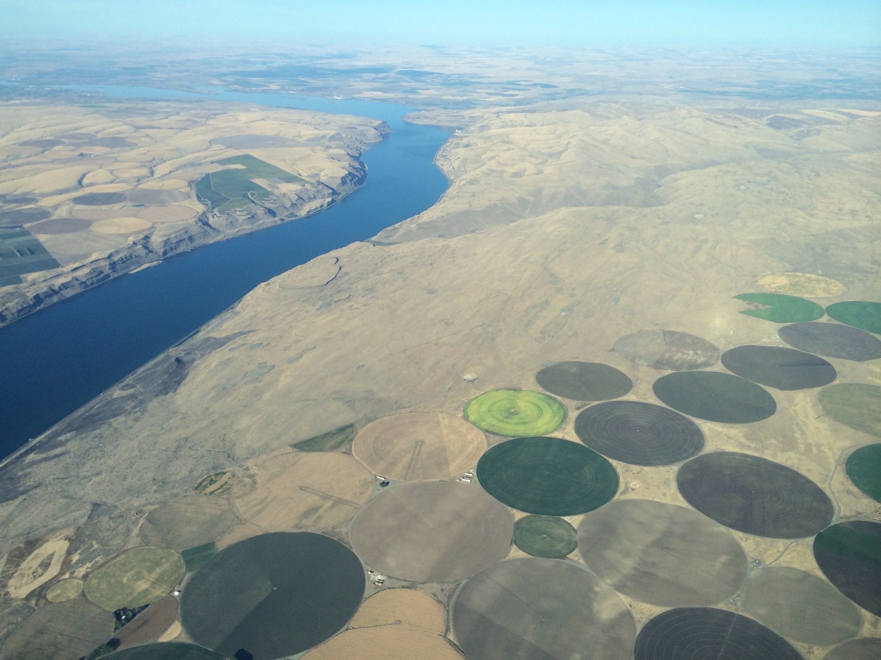
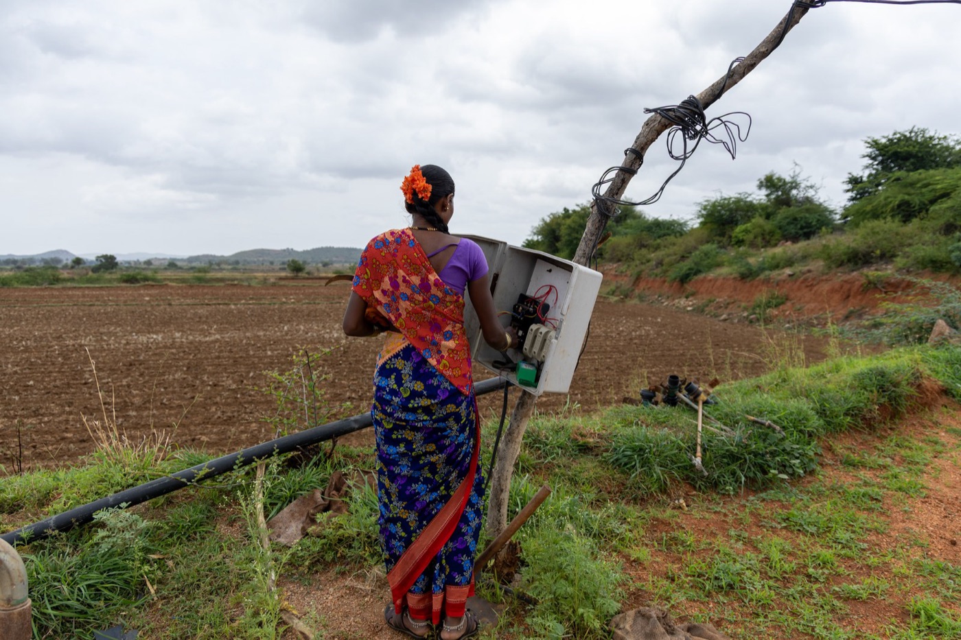
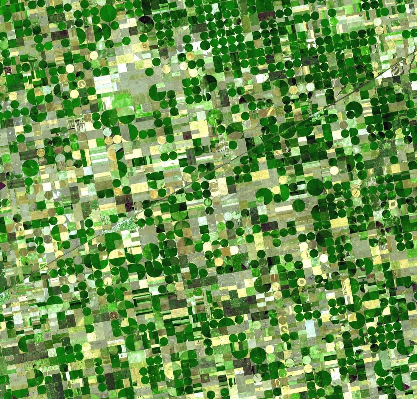
The pump changed everything. Until the 1950s a well was a bucket or a hand pump and it drew what a family or a village needed; the electric and diesel pump, spread through India, China, the American plains and the Middle East from the 1960s, drew what a field needed, which is a thousand times more, and the green revolution of Asia was, to a large extent, a groundwater revolution. India has about twenty million irrigation wells and pumps about 250 cubic kilometres a year, more than any other country and more than the United States and China together, with electricity that the states subsidise to nothing, so that a farmer in Punjab or Gujarat pumps until the pump runs dry and then drills deeper. The North China Plain, which grows the country's wheat, has drawn its water table down by tens of metres. The Ogallala aquifer under the American plains, which was filled in the ice ages and recharges at a few millimetres a year, has lost, in parts of Kansas and Texas, most of the water it had in 1950, and the irrigated circles of the plains are being turned back to dry wheat as the wells fail. The Central Valley of California, which the Phoenix and almond articles on this site touch, pumps hardest in a drought and has sunk, in places, by nine metres.
The cities pump too. Mexico City, Jakarta, Tehran, Beijing, Bangalore and Dhaka, on this site, are all cities living on aquifers they are emptying, and their articles describe what follows: wells that deepen each year, ground that sinks, and a shift, late and expensive, to water brought from further away.
| Where the water table is falling fastest | |
|---|---|
| Northern India and Pakistan | The largest depletion on Earth; subsidised electricity; 20 million wells |
| North China Plain | Tens of metres since the 1960s; the south to north transfer built to relieve it |
| Ogallala, American plains | A fossil aquifer; largely gone in southern Kansas and the Texas panhandle |
| Central Valley, California | Pumped hardest in droughts; subsidence up to 9 metres |
| Arabian peninsula and North Africa | Fossil water; Saudi wheat grown and abandoned on it |
| Iran | The most rapid decline of any country in the 2010s |
What the satellites saw
From 2002 a pair of satellites called GRACE, flying in formation, measured the Earth's gravity finely enough to detect the mass of water moving on and under its surface, and their maps of change over fifteen years are the clearest picture of groundwater the world has. They show the water table falling across northern India at a rate that adds up to the largest loss of water anywhere; across the North China Plain, the Middle East from Turkey to Iran, the Central Valley, the Ogallala, the Murray Darling in its drought, and the Caspian basin; and rising, in a few places, where the rain has increased or the pumping has been reined in. The satellites cannot see a well. They can see the sum of all the wells, and the sum is a loss of a few hundred cubic kilometres a year, most of which ends up, after passing through crops and rivers, in the sea.
A study in 2024 of a hundred and seventy thousand wells in forty countries found the water table falling in most of the world's aquifers and falling faster in the twenty first century than the twentieth, with the exceptions, a few dozen aquifers that had recovered, all in places where pumping had been limited by law or water brought from elsewhere. Recovery is possible. It has to be decided.
Fossil water
Some of the water underground fell as rain in a wetter climate ten thousand or more years ago and has not been replaced since, and it is called fossil water because, like oil, it is a stock and not a flow. The Nubian sandstone under Egypt, Libya, Sudan and Chad holds more water than the Nile carries in five hundred years, and Libya's Great Man Made River, built in the 1980s and 1990s, pumps it to the coast. The Arabian peninsula's aquifers grew Saudi Arabia's wheat in the 1980s and 1990s, at a cost of most of the water, until the programme was ended in 2016 and the wheat was imported instead. The Ogallala is mostly fossil. Water of that kind cannot be managed sustainably, because there is no sustainable rate; it can only be spent slowly or fast, on something worth it or not.
Why it is hard to govern
A river can be seen, measured at a gauge and divided by a treaty. An aquifer is invisible, crosses every boundary drawn on the surface, and is reached by a well on private land that, in most of the world's law, belongs to the landowner with the water under it. A thousand farmers over an aquifer are a thousand people drawing from one account with no statement, and each has every reason to pump before the neighbour does. The places that have slowed the fall have done it by metering wells, by charging for electricity, by capping pumping district by district, as California began in 2014 and India has barely started, and by putting water back: the managed recharge that Orange County and Perth practise, sending treated water or flood water into the aquifer on purpose. The rest are living on the loan.
What comes up with it
The water that has sat in rock for centuries carries the rock, and the arsenic, fluoride and nitrate articles on this site are all groundwater stories: the arsenic of the Bengal delta and the fluoride of the Rift Valley and the Indian plains are in the sediment and the rock and dissolve into the water that sits in them, and the nitrate is what the fields above put down. Groundwater is also, in most of the world, the cleanest water there is, filtered through tens of metres of sand, free of the bacteria and the organic matter that a river carries, and needing, at a well run works, little more than a chlorine dose. The deeper the well, the older and cleaner the water and the less of it there is to come. The pump, which made it possible to draw on the deep stock, made it possible to spend it, and the same drill that reaches clean water reaches water that will not be replaced.
What it teaches
Groundwater is the plain water article about the water nobody can see, and it is the largest stock on this site and the one being spent fastest. A third of what the world uses comes from the ground, half of what it drinks, and in the regions that feed most of its people it comes faster than the rain puts it back, from wells that no one meters, on land that no treaty covers. The satellites can see the total falling. The fix is the one every falling aquifer on this site has reached in the end: pump less, put some back, and decide what the stock is for.
A thousand cubic kilometres a year, a fifth of it never replaced, and the ground sinking where the wells go deepest.
Sources
- Wada, Y. et al. (2010). Global depletion of groundwater resources. Geophysical Research Letters 37. Depletion about 280 cubic kilometres a year.
- Rodell, M. et al. (2018). Emerging trends in global freshwater availability. Nature 557. GRACE satellite observations 2002 to 2016.
- UNESCO and IGRAC, United Nations World Water Development Report 2022: Groundwater, making the invisible visible. About 1,000 cubic kilometres a year abstracted; India the largest user.
- Jasechko, S. et al. (2024). Rapid groundwater decline and some cases of recovery in aquifers globally. Nature 625. 170,000 wells in 40 countries.
- Famiglietti, J.S. (2014). The global groundwater crisis. Nature Climate Change 4.
- Photographs: opener: Hermiston area aerial (34522051522) by Sam Beebe (CC BY) via Wikimedia Commons; inline: Woman operating an electrical pump starter for irrigation in Raichur by Vraj Acharya (CC BY-SA) via Wikimedia Commons; inline: Crops Kansas AST 20010624 by NASA (Public domain) via Wikimedia Commons.